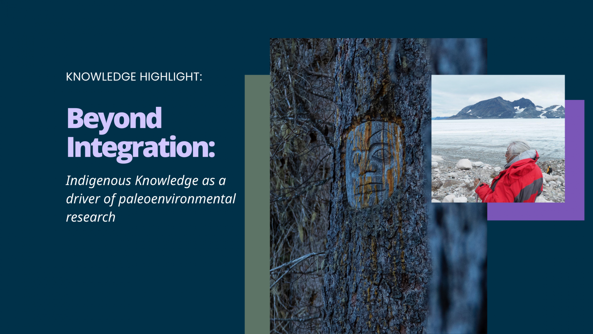
By: Ben Louter
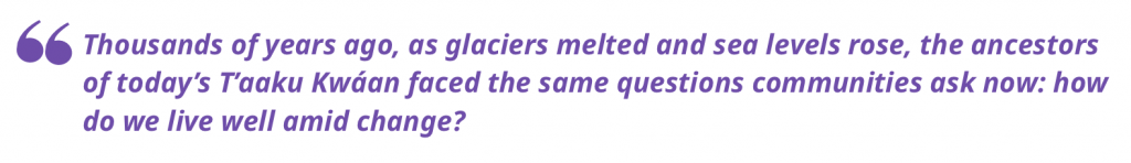
The Taku River watershed lies at the head of the Inside Passage, flowing from the glaciers of northwestern British Columbia into the fjords of Southeast Alaska. Taku Inlet terminates into the Pacific just south of Juneau, Alaska. It is a vast and largely undeveloped landscape; home to moose, salmon, grizzly bears, and the enduring presence of the T’aaku Kwáan, whose ancestors have lived here for thousands of years. To this day, Tlingit people describe this river as “Grandfather”, a living being with memory; a relative. Its channels and floodplains record histories of glacial advance and retreat, volcanic ashfall, and rising seas. In this sense, the Taku is not only a place of research but a teacher of change.
I was invited into this landscape through relationships I have built over many years of collaboration with the Taku River Tlingit First Nation (TRTFN). I am undertaking doctoral research in paleoenvironmental reconstruction and geomorphology in the Faculty of Environmental Studies at UVic, under the supervision of Dr. Darcy Matthews. My work as a non-Indigenous researcher has been guided by Elders and knowledge holders who carry oral histories of ancestral movements, ice retreat, and shifting sea levels. I feel privileged to call many Elders and knowledge holders friends and teachers. Together, we are asking questions that link deep time with living memory: how did the T’aaku Kwáan (the Tlingit people of the Taku River region and the traditional name used by TRTFN) adapt to early Holocene sea level rise and glacial change? What traces of those adaptations remain in the landscape and in stories today? And what might those teachings offer as communities once again face accelerating climate change?
This partnership is not only about studying the past; it is also about creating points of connection between different knowledge systems. Through the Taku Ancient Landscapes project, we are working to reconstruct paleoenvironmental histories while strengthening the capacity of TRTFN to govern, interpret, and steward their own heritage and environmental data. The research emerges from TRTFN-identified priorities and will return home to Atlin B.C. through their digital heritage systems, community workshops, and youth training programs.
The Taku River ecosystem contains a wealth of knowledge. Its waters and glaciers braid Indigenous oral histories, archaeological records, and geological evidence into one ongoing story of adaptation.
A changing river,
An enduring presence
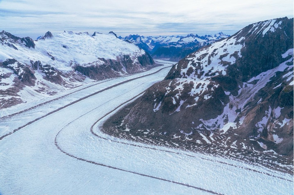
The early Holocene, roughly 11,000 to 8,000 years ago, was a period of profound transformation across the North Pacific. As ice retreated, meltwater from the great continental glaciers raised global sea levels by more than 200 metres in this subarctic zone. In coastal British Columbia and Southeast Alaska, shorelines were repeatedly inundated and exposed as local crustal uplift interacted with global ocean rise. Archaeological sites that once overlooked the sea now lie buried far inland, while others are submerged beneath tidal estuaries. Yet amid this flux, oral histories maintained by the T’aaku Kwáan speak of ancestral settlements, trade, and travel through a landscape filled with abundant and often capricious glaciers. The etymology of the words “T’aaku Kwaan”—Geese Flood Upriver Tribe—is inseparable from the glacial landscape it describes, recalling a time when the Taku Glacier dammed the river, creating a vast ice dammed proglacial lake that drew waterfowl, a moment preserved in both oral history and in glaciological records.
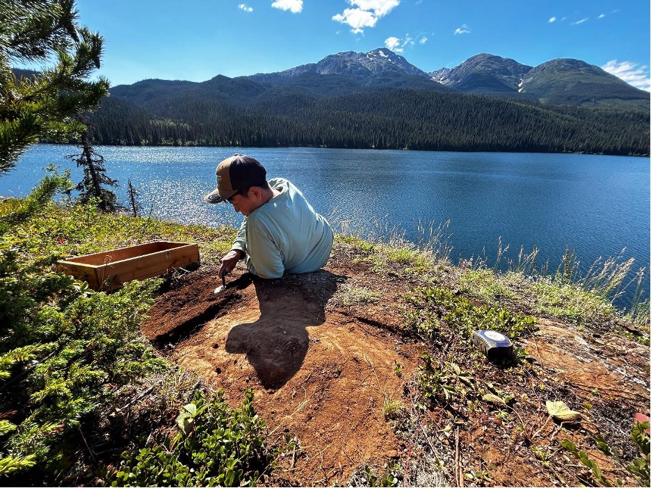
Despite the cultural and ecological richness of the Taku, its remoteness, combined with the complexity of postglacial geomorphology, has left significant gaps in understanding how people responded to early Holocene environmental change. Reconstructing this history requires both scientific and cultural knowledge; radiocarbon dating and isolated pond sediment analysis alongside Tlingit stories and place names that preserve environmental memory.
For the Taku River Tlingit First Nation, this work builds directly on the Nation’s long-term stewardship initiatives, including the Wóoshtin wudidaa Atlin Taku Land Use Plan and the T’akú Tlatsini Indigenous Protected and Conserved Area (IPCA). Both frameworks emphasize the integration of Indigenous knowledge and western science to guide decision-making about land, water, and climate. Understanding how the T’aaku Kwáan adapted to ancient sea level rise, and rapidly changing ecology provides a deep-time perspective on resilience; one that connects to modern priorities around climate adaptation, food sovereignty, and cultural continuity.
In this context, the Taku Ancient Landscapes project is not simply an academic inquiry. It is part of a living effort to reconnect environmental change with cultural meaning, to strengthen Indigenous governance of heritage, and to remind us that adaptation has always been a relational process. The same currents that shaped the early Holocene landscape continue to shape the future of the Taku today.
Research overview:
reconstructing ancient landscapes
The Taku Ancient Landscapes project brings together archaeology, geomorphology, and Indigenous knowledge to reconstruct how the T’aaku Kwáan homeland changed after the last ice age. At its core, the project seeks to understand how early peoples adapted to rising seas, shifting river systems, and new ecological opportunities as glaciers retreated from the Coast Mountains.
Our research combines multiple methods:
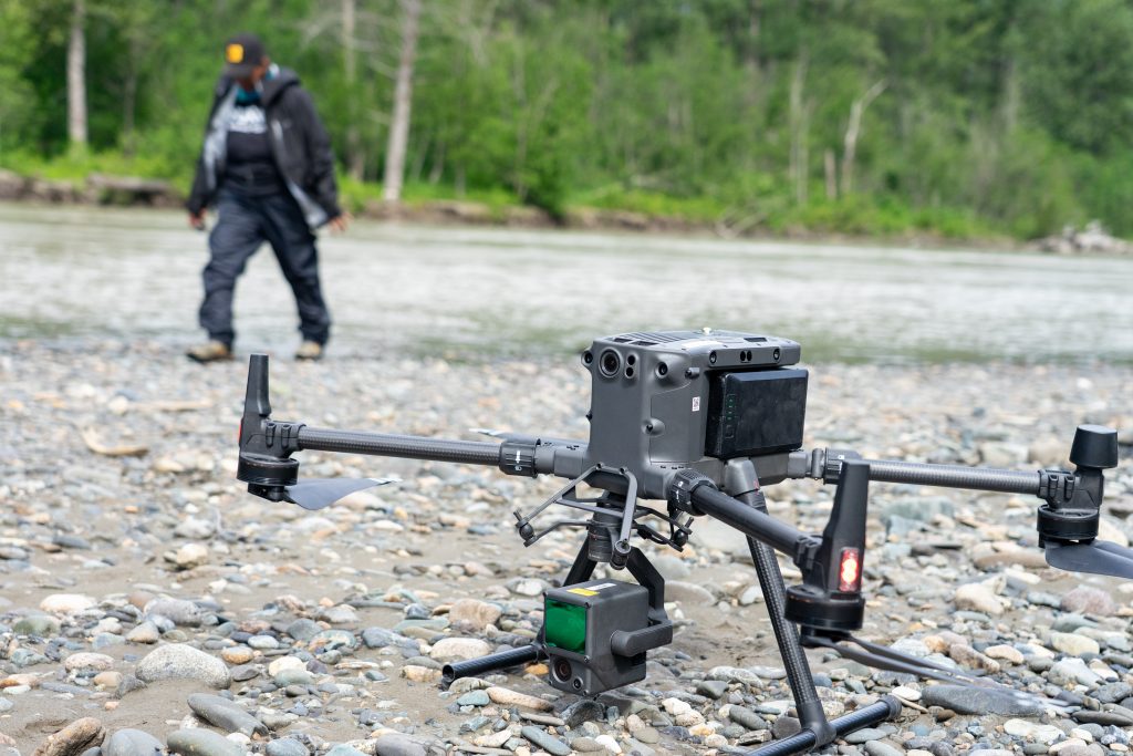
- Geomorphological mapping and LiDAR analysis identify former shorelines, terraces, and paleo-channels that once bordered postglacial lakes and marine inlets.
- Sediment coring (pollen+diatoms) and radiocarbon dating of organic layers provide a timeline for deglaciation and sea level change.
- Cosmogenic nuclide dating of glacial erratics and glacial morphology.
- X-ray fluorescence (XRF) analysis of obsidian belongings originating in the Taku basin helps trace ancient trade and mobility networks between communities.
- Ethnohistoric and oral history research, conducted in partnership with T’aaku Kwáan Elders, anchors these findings in stories, place names, and teachings that remember the shape of an earlier world.
Together, these data are being integrated into a GIS-based cultural landscape model, co-managed by the Taku River Tlingit First Nation (TRTFN). TRTFN retains authority over how data are stored, accessed, interpreted, and shared. Spatial data, oral histories, and archaeological information are housed in TRTFN-controlled databases, with permissions and use governed by Indigenous protocols and community decision-making. Research priorities and interpretations are discussed collaboratively. The models map how sea level rise and isostatic rebound interacted to reshape valleys and shorelines, revealing where ancient camps, harvesting areas, and travel routes may now lie hidden above the current high-water mark. This work directly informs TRTFN’s heritage management and future archaeological surveys, identifying zones of high cultural potential before development or climate impacts disturb them.
Equally important, this research is building a foundation for data sovereignty and digital heritage governance. All spatial, archaeological, and oral data are being archived through the TRTFN Mukurtu digital heritage platform, where access and interpretation are determined by community protocols and Tlingit law. In this way, the project strengthens not only scientific understanding but also Indigenous authority over cultural knowledge and territory.
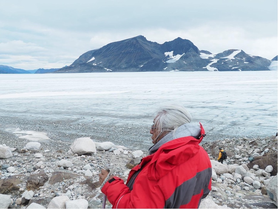
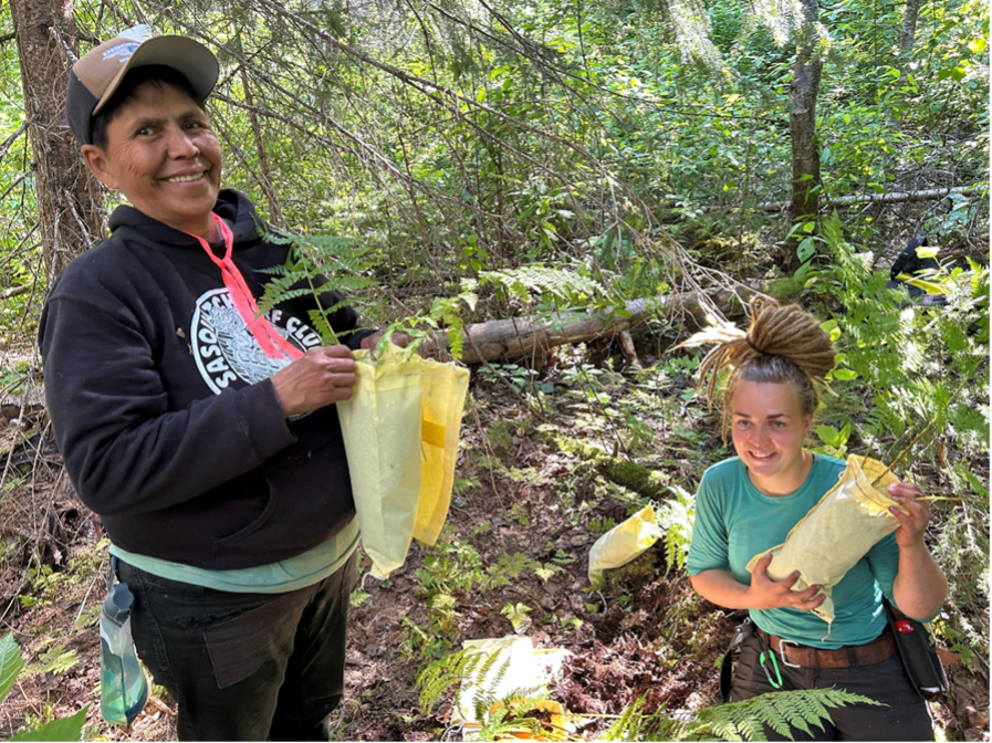
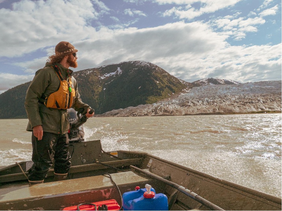
The research process itself is iterative and relational. Each field season begins and ends with conversations with Elders around kitchen tables, with Guardians on the land, and with youth and community members learning to use LiDAR, GPS, and coring tools. The science emerges from these relationships, shaped by community priorities and guided by the principle that knowledge must serve the land and the people who belong to it.
Reciprocity
ON the ground
From its inception, the Taku Ancient Landscapes project has been shaped by the priorities, leadership, and Knowledge systems of the Taku River Tlingit First Nation (TRTFN). The research questions emerged from community discussions about how climate change and industrial pressures are affecting ancestral lands, and how scientific tools might help visualize what Elders have always known.
All aspects of the project operate under TRTFN’s heritage research framework ensuring that data ownership, intellectual property, and decision-making rest with the Nation. Research agreements follow OCAP® and CARE principles, emphasizing Ownership, Control, Access, and Possession, alongside Collective benefit, Authority to control, Responsibility, and Ethics. These frameworks ensure that information flows both ways: from field to community, and from community to the broader world, always under the direction of TRTFN leadership.
Every dataset is stored within the Nation’s Mukurtu heritage archive, where access protocols are defined by Tlingit law. Elders can choose what is shared publicly and what remains within clan stewardship. This structure transforms what is often extractive research into a model of community-controlled knowledge creation, an approach that is both ethically rigorous and deeply relational. We are actively working towards establishing an archaeology repository in-community as well, so we can begin to repatriate At.oow (Clan-owned property) from museums and private collections.
Each field season brings together a small team of Elders, Guardians, scientists, and youth. Youth and community members learn not only how to use LiDAR, GPS, and coring tools, but how to read the subtle indicators of former shorelines, how to see archaeology as a living conversation with their own ancestors.
Reciprocity also means recognizing that western science has much to learn from Indigenous frameworks. Oral histories that once guided seasonal movement now inform geomorphological hypotheses. Place names describing ancient village sites, now situated on elevated terraces high above the surface of the river,
Knowledge exchange flows in both directions. Scientific results are presented first to TRTFN Clan leaders and community members, then, only with approval, shared publicly through academic venues. Workshops in Atlin and on the river ensure that each new dataset or interpretation returns home before it travels outward.
REFLECTIONS:
TEACHING ON CLIMATE ADAPTATION
Standing on the banks of the Taku River, it’s impossible not to feel time moving through the landscape. The terraces that rise above the valley floor are the marks of ancient shorelines, each one a memory of a world in flux. Thousands of years ago, as glaciers melted and sea levels rose, the ancestors of today’s T’aaku Kwáan faced the same questions communities ask now: how do we live well amid change? How do we stay connected to place when the ground itself is shifting?
The early Holocene was not only a time of loss, but it was also a time of renewal. As new lakes and river systems formed, fresh salmon runs appeared, new valleys opened, and people adapted their lifeways to the rhythms of a transforming world. In a striking parallel to today, a 2023 study by Jonathan Moore and collaborators, including the Taku River Tlingit First Nation (TRTFN), shows that retreating glaciers in the Tulsequah watershed (one of the Taku’s many tributaries) are creating new salmon habitats; yet these emerging ecosystems face pressure from mining and industrial development.
Oral histories from the T’aaku Kwáan describe movements inland and upland, the establishment of new trade routes, and the persistence of kin connections to coastal places long after seas levels receded to modern day levels.
ALIGNING WITH
THE BC FIRST NATIONS CLIMATE STRATEGY AND DRRAP
The Taku Ancient Landscapes project aligns closely with the BC First Nations Climate Strategy and Action Plan and Canada’s National Adaptation Strategy, both of which emphasize Indigenous-led, place-based approaches to climate resilience. Central to the BC First Nations Climate Strategy is the recognition that Indigenous Knowledge is not supplementary to western science, but foundational to building climate resilience across generations.
This research is conducted within and in direct support of the T’akú Tlatsini Indigenous Protected and Conserved Area (IPCA) and associated TRTFN–B.C. Government-to-Government land and resource management frameworks. The T’akú IPCA encompasses the Taku watershed and advances a shared vision for protected and specially managed landscapes with enhanced Indigenous authority over decision-making, in alignment with UNDRIP and the Declaration on the Rights of Indigenous Peoples Act. By generating new environmental and cultural knowledge, this project supports ongoing Tlatsini planning, adaptive land-use governance, and the Province’s commitment to protect 30% of land and water by 2030.
By documenting how the T’aaku Kwáan adapted to rapid environmental change over thousands of years, this project provides a deep-time perspective that strengthens contemporary climate planning, preparedness, and adaptation pathways. Indigenous oral histories, place names, and land-based teachings provide long-term environmental records that extend far beyond instrumental datasets. Integrating these Knowledge systems with paleoenvironmental science offers evidence-based insights into landscape sensitivity, resilience, and adaptation strategies relevant to current and future climate decision-making.
The project directly responds to the Strategy’s call to expand climate planning beyond short-term environmental records by reconstructing early Holocene sea-level rise, ecological succession and glacial retreat. This work contributes to the Strategy’s Climate Preparedness, Land and Water Protection, and Capacity and Leadership pathways by embedding scientific tools (such as LiDAR, GIS, sediment coring, geochemical analysis, and archaeological survey) within TRTFN-led stewardship and governance frameworks. Rather than extracting data, the project aims to build long-term community capacity to monitor, interpret, and protect ancestral landscapes under accelerating climate and development pressures.
In parallel, the project supports the intent of British Columbia’s Disaster Risk Reduction and Adaptation Action Plan (DRRAP) by identifying how past environmental transformations shaped floodplains, shorelines, and travel corridors. Understanding these ancient patterns of landscape response offers critical insight for anticipating future climate-related hazards, including flooding, erosion, and ecosystem shifts, particularly in remote and Indigenous-governed watersheds.
BEST PRACTICES AND RECOMMENDATIONS
For climate adaptation research
Working in the Taku River watershed has made it clear that climate adaptation is not only a technical challenge, but a relational and cultural one. The project has shown me that landscapes hold layered memories of change, and that Indigenous Knowledge systems already contain sophisticated records of past adaptation. By bringing paleoenvironmental science into dialogue with T’aaku Kwáan oral histories, place names, and governance structures, this work has highlighted how deep-time perspectives can strengthen contemporary climate planning.
Several transferable best practices have emerged from this project that are relevant to climate adaptation initiatives across British Columbia:
- Centre Indigenous governance from the outset.
Climate research is most effective when it operates within Indigenous-led decision-making frameworks that affirm Title, Rights, and jurisdiction, rather than treating consultation as an afterthought. - Use long-term environmental records where they already exist.
Archaeological, paleoenvironmental, and Indigenous oral history records documenting early Holocene sea-level rise and glacial retreat already exist across much of coastal British Columbia and Southeast Alaska. Incorporating these records into climate risk assessments provides valuable context for landscape sensitivity and long-term change without requiring new large-scale data collection. - Treat oral histories and place names as climate data.
Stories, language, and place-based teachings encode long-term environmental observations that can guide scientific sampling, hazard assessment, and land-use planning. - Pair spatial tools with lived knowledge.
GIS, LiDAR, and digital elevation models are most powerful when used to visualize Indigenous environmental memory, allowing communities to “see” ancestral landscapes and interpret them through their own knowledge systems. - Build reciprocal capacity, not dependency.
Training youth and community members in climate and heritage monitoring strengthens long-term resilience while ensuring research benefits remain in-community.
Together, these practices suggest that effective climate adaptation research must move beyond extracting data toward building long-term relationships, governance capacity, and shared interpretation. In the Taku, adaptation is understood not as a discrete intervention, but as a continuation of ancestral practices of stewardship. Bringing scientific tools into these relationships has reinforced what T’aaku Kwáan Elders have long taught: that resilience is rooted in place and responsibility to future generations.
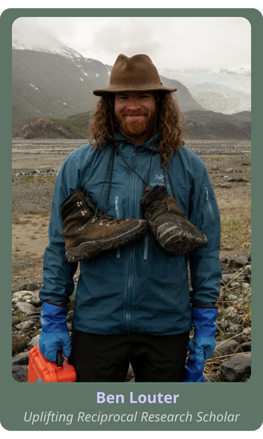
Ben Louter is a PhD candidate at the University of Victoria, and a recipient of a PICS Uplifting Reciprocal Research Scholarship.
