Understanding why post-wildfire flow increases are temporary during dry summers
By: Shixuan Lyu
In the semi-arid landscape of the Okanagan Valley, water security is fundamentally tied to the health of our forested watersheds. However, in recent years, this balance has been disrupted as climate change has driven increasingly frequent and catastrophic wildfires. The 2021 White Rock Lake and 2023 McDougall Creek fires, in particularly, severely impacted critical community watersheds—the primary sources of local drinking water (Figure 1).
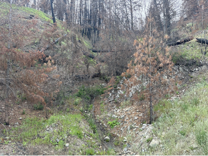
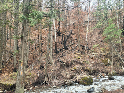
Figure 1. Left: Whiteman Creek, 3 years after the wildfire. Right: McDougall Creek, 1 year after the wildfire. Credit: Shixuan Lyu, 06/24.
I’m Shixuan Lyu, a PhD student at UBC Okanagan. My research focuses on a simple but critical question: during the dry season, how much water is left in our rivers, and how does climate change and forest changes affect water availability? In order to answer this question, I began working with the Westbank First Nation (WFN), Okanagan Nation Alliance (ONA) and Okanagan Indian Band (OKIB) in 2024, which was my first year living in Canada. A key part of my PhD work is studying how wildfires impact summer water levels in the Okanagan Valley. Communities were worried about what the fires did to their water. Would there be enough (quantity)? Would it be safe to drink (quality)? Because of these concerns, ONA’s hydrologist, Dr. George Wang, reached out to my supervisor, Dr. Adam Wei. He asked for our help to study wildfire impacts on the water supply during the dry summer season.
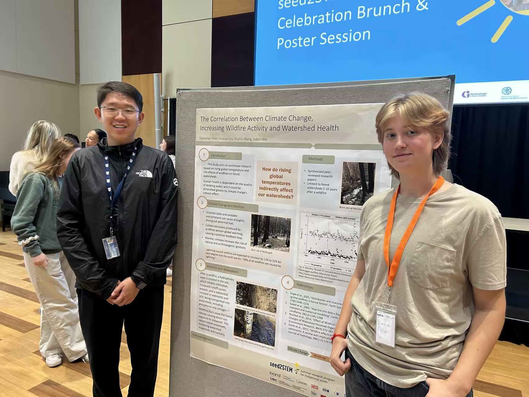
Our group also joined the seed2STEM program, a project connecting UBC researchers with local Indigenous high-school students. We had the opportunity to mentor a student, teaching them how to collect water samples and learn the basics of how to care for our water sources after a wildfire (Figure 2).
Research Implementation
Once we understood what the WFN and ONA were interested in researching, our research team headed out to the burned areas, to the monitoring stations that had already been set up. These stations gave us excellent, continuous data on how much water was flowing in the creeks. But there was a crucial piece missing: no one had tested the water quality either before or after the fires.
This became our top priority. Starting in May 2024, I began collecting water samples every single week from five local creeks (Figure 3): Equesis, Naswhito, Whiteman, Shorts, and McDougall. The first four of these creeks are on OKIB lands. We also collected samples of rain, snow, and groundwater (Figure 3). This helps us understand where the creek water comes from during the dry summer, and to see if the wildfire changed its source.
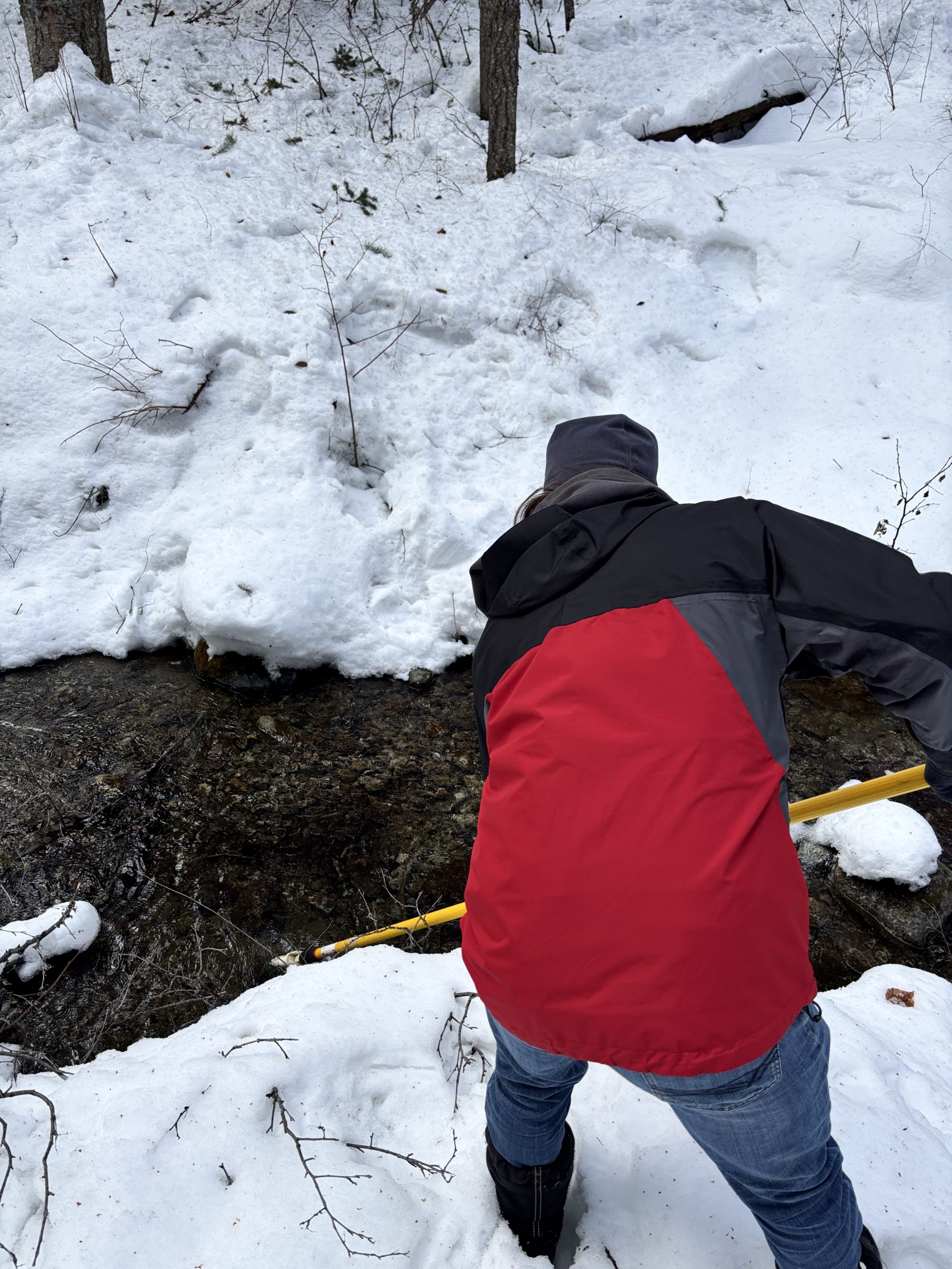
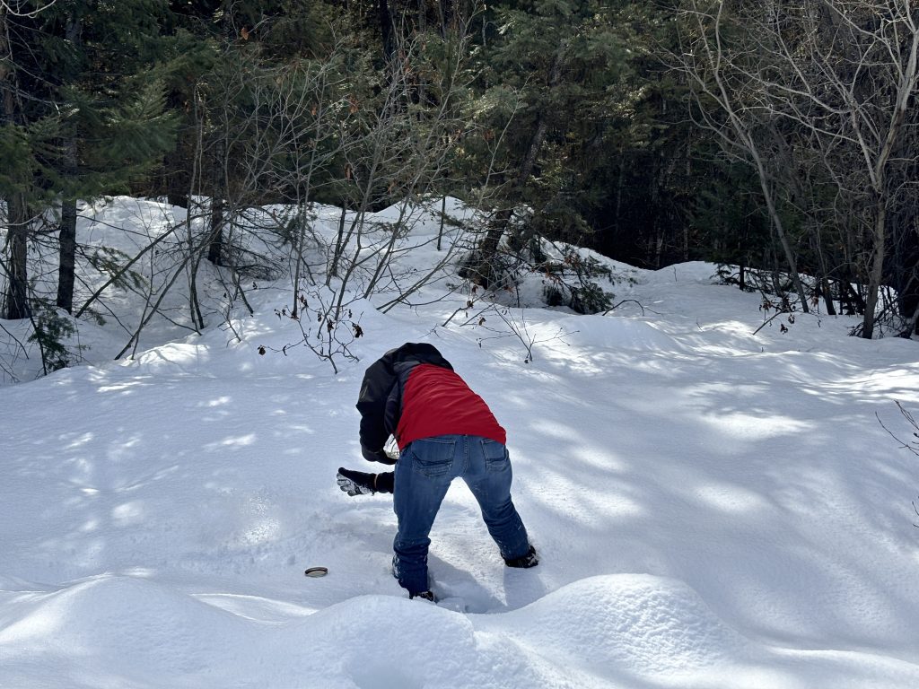
Figure 3. Left: Our team member, Gavin Newall, collecting a water sample from McDougall Creek. Right: Gavin collecting a snow sample for testing. Credit: Shixuan Lyu, 03/25.
Preliminary results
AND INSIGHTS
We have already published the first part of this study in Forest Ecosystems, which focused on the 2021 wildfire in OKIB’s region. And the paper highlights 1) how the fire affected the water and, more importantly, 2) why it happened.
Our key findings show that after the wildfire, there was actually more water in the river during the summer. This happened because the burned trees stopped “drinking” water from the soil. At the same time, without a forest canopy to catch the snow, more snowmelt soaked deep into the ground. This “recharged” the underground water supply, which then slowly fed the river and kept it flowing through the dry summer.
However, our work on the 2023 McDougall Creek fire shows a completely different and worrying trend. While we still need at least two more years of data to draw final conclusions, early analysis shows that the McDougall Creek river completely ran dry just two years after the fire (Figure 4). On top of that, the water quality is much worse here than in the other burned areas. This tells us that not all watersheds react to fire the same way. We still have a lot of work to do to understand why this is happening.
Connections to the
PROVINCIAL STRATEGY
Our study directly supports the BC First Nations Climate Strategy and Action Plan in several key areas:
Water, Watershed, and Ocean Protection
At its heart, our research is all about water and the watersheds that hold it. We are focused on how the recent, devastating wildfires have impacted this critical resource. Our study provides the essential scientific data to answer these urgent questions. This information is the foundation for creating better plans to protect our rivers and drinking water in a future with more fires.
Forest Protection and Sustainable Management & Resource Management
Our research also looks at the land itself. We study how well the burned forests and soil can soak up and store water—much like a natural sponge. Understanding this helps us pinpoint which forest areas are most critical for helping to prevent both floods and droughts. This knowledge directly supports Indigenous communities in making wise, long-term decisions about forestry and how to best use and care for their lands.
Build Long-Term Climate Capacity
Our work is a direct example of building long-term climate capacity. We are not just researchers; we are partners with the WFN, ONA and OKIB, co-establishing a water monitoring network that is run by the community itself. More importantly, we train Indigenous youth and community members, teaching them how to collect data, analyze it, and understand what it means.
This approach creates a monitoring framework that can be shared and copied. It empowers more Indigenous communities to rely on their own strength to face future water challenges from climate change.
Strengthen the Incorporation of Indigenous Knowledge
Our project strengthens knowledge in a “two-way” partnership. The community-run monitoring networks and our training empower Indigenous youth and community members to use scientific tools to observe their own lands.
This allows them to weave new, precise data together with their deeply held, generational understanding of the land and water (which is Indigenous Knowledge). This combination ensures that water protection plans are built not only on precise data but are also rooted in the community’s own wisdom and values.
Our study directly supports the Action Plan for Disaster Risk Reduction in several key areas:
Understanding Disaster Risk
Our study is all about understanding the new risks that wildfires create. We analyze how fires change the flow of rivers, which can lead to more severe droughts or floods. This work provides risk assessments that are driven by the community and tailored specifically to their Indigenous territories. Most importantly, we provide data they can act on immediately. This helps the community pinpoint which of their water sources are in the most danger and decide what to protect first.
Strengthening Disaster Risk Governance to Manage Disaster Risk – Multi-Agency Support Teams
Our project is a living example of this multi-agency teamwork. We have built a direct partnership that connects Indigenous communities (WFN, ONA, and OKIB), scientists (UBC), and local government authorities (B.C. Ministry of Forests). This connection ensures everyone is sharing the same information, creating a coordinated plan where scientific data supports Indigenous leadership. This approach helps build better disaster plans that are integrated, effective, and, most importantly, respect the ONA’s governance and authority over their own territories.
Transferable learnings for community adaptation and mitigation
Our work has revealed critical lessons that other communities can use, especially in the Okanagan Valley. First, we identified the specific post-fire risks: the danger of spring floods is high, while the impact on summer water supply is highly uncertain and can be different in each watershed.
Second, we identified key gaps in our monitoring. The Okanagan needs more hydrometric stations, automated sensors for real-time water quality testing, and better weather tracking, especially for snowfall. In terms of management, we learned that data must be made easier for everyone to access, and that local community members can be trained to support data collection efforts.
Using all these lessons, WFN and ONA are working to make McDougall Creek a leading example. This project will provide a proven framework and practical experience for other communities to follow.
InSIGHTS FROM THE STUDY:
INTEGRATING INDIGENOUS KNOWLEDGE WITH HYDROLOGICAL STUDIES
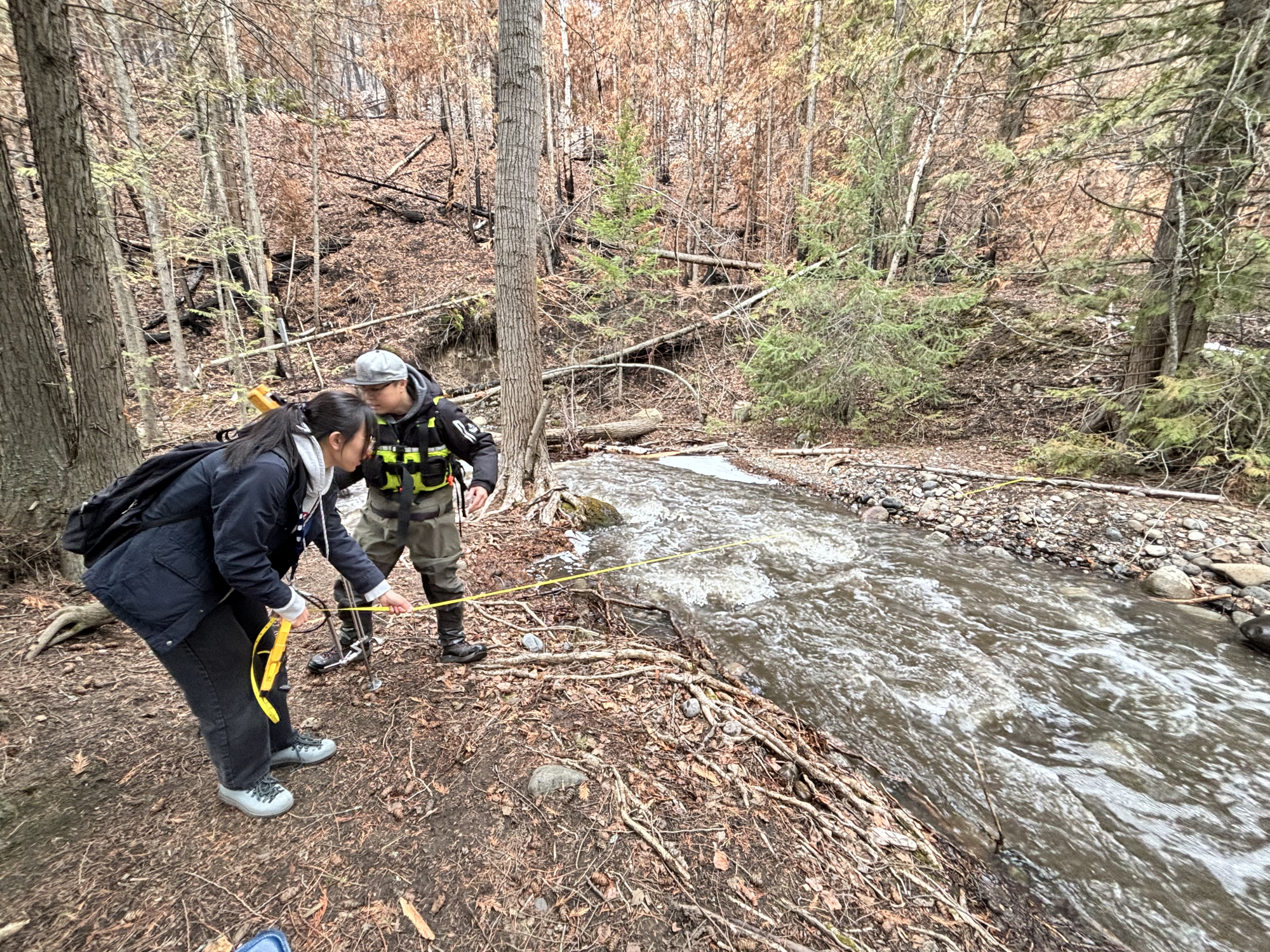
The collaboration with WFN, ONA and OKIB has fundamentally reshaped my research perspective. Moving beyond theoretical modelling, our partnership — initiated by the communities’ concerns over the McDougall Creek wildfire — provided me with direct insights into the local landscape’s vulnerability. By participating in data collection with ONA staff (Figure 5), I learned that water security is not just a numerical value of streamflow, but a critical pillar of community resilience and cultural continuity. This realization led us to refine our research questions to prioritize the specific sub-basins that the community identifies as most vital for their seasonal water supply.

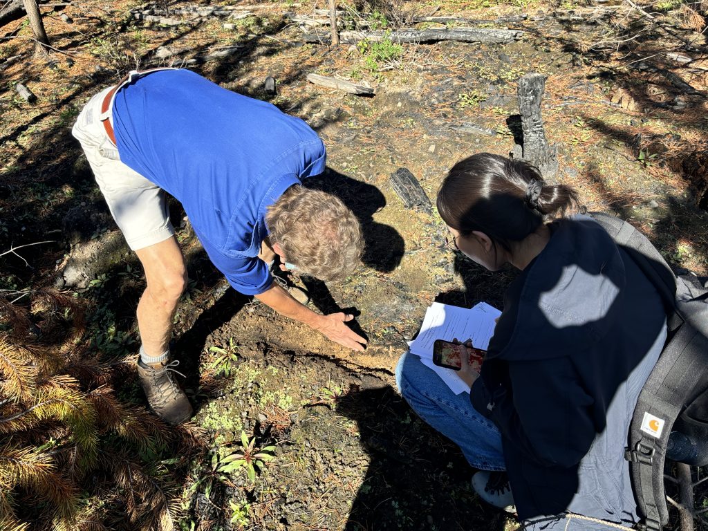
Figure 5. Left: UBC Okanagan student Shuhui Wang and ONA’s George Wang working together to maintain a water monitoring station in McDougall Creek. Right: UBC Okanagan’s Dr. David Scott and Shuhui measuring how well the soil absorbs water in McDougall Creek’s upper areas. Credit: Shixuan Lyu.
What I gained from the study:
Practices for fostering meaningful university-community partnerships
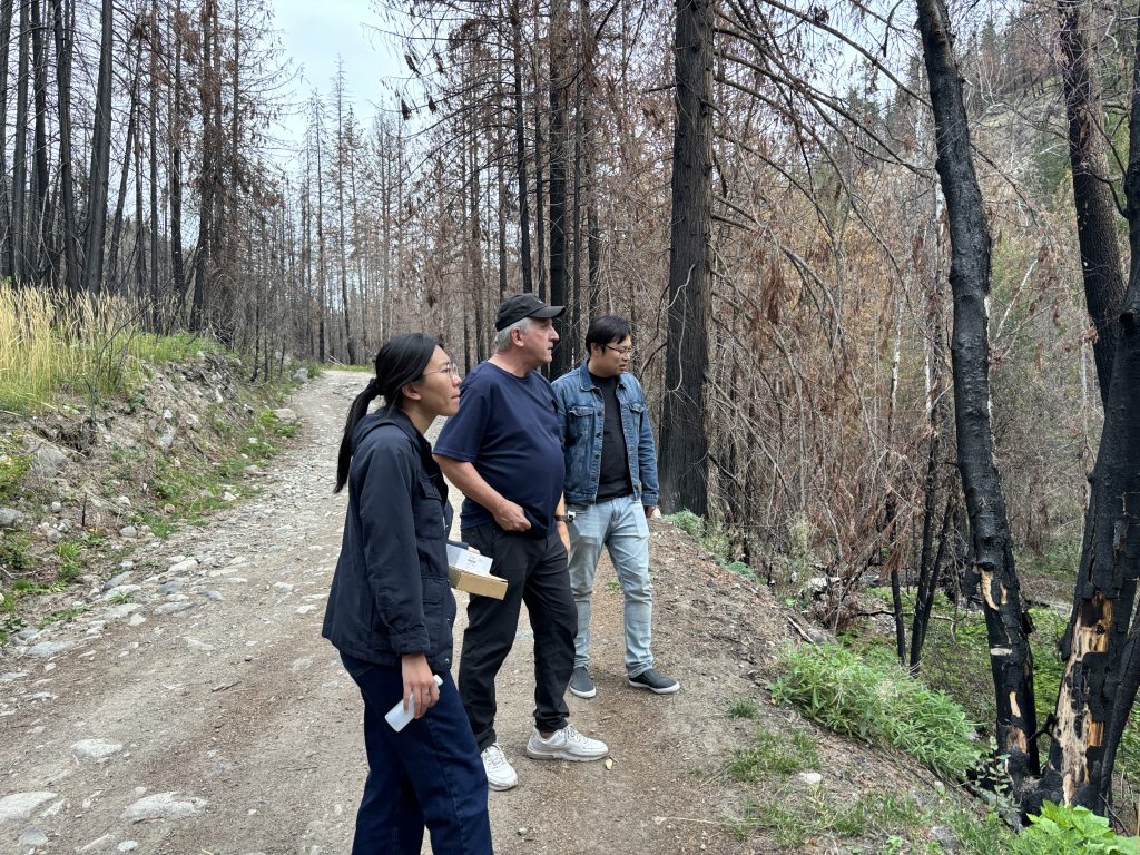
Figure 6. Left: Visiting expert, Prof. Keith Smettem, surveying the burned area in McDougall Creek. Credit: Shixuan Lyu. Right: Our research team with the Indigenous high-school student who joined us for the summer seed2STEM program. Credit: seed2STEM team.
Our partnership operates on a model of knowledge co-creation rather than simple data collection.
The “knowledge bridge” as an iterative process
Acting as a “knowledge bridge” taught me that effective research requires a feedback loop. When we invited experts to the burned watershed (Figure 6), the insight gained was not just technical; it was a synthesis of high-level wildfire science and the First Nations’ ancestral knowledge of the land. This “Two-Eyed Seeing” approach ensures our disaster prevention strategies are both scientifically robust and culturally grounded.
Capacity building and long-term reciprocity
Through the seed2STEM program, we mentor local Indigenous high-school students. This experience taught me that reciprocity is about sustainability. By sharing our lab resources, we are not just completing a project; we are helping to build the local capacity for future environmental stewardship. The insight here is clear: the most impactful research is that which empowers the community to lead their own environmental monitoring in the long term.
Recommendations for
future research and partnerships
Reflecting on this journey, I realize that the most significant “Knowledge Highlight” of my PhD is not just the data we collected, but the transformation of the research process itself.
Coming to Canada and the Okanagan as a researcher, I initially saw wildfires through the lens of hydrological variables and data points. However, through the guidance of the WFN, ONA, and OKIB, I have learned that true scientific rigor is inseparable from social responsibility.

This partnership has taught me that the “dry season” is not just a seasonal low in a hydrograph; it is a period of heightened vulnerability for the land and its people. Moving forward, my research will continue to honour this “Two-Eyed Seeing” approach—integrating technical excellence with deep respect for Indigenous knowledge. This collaborative model ensures that our science does not just end up in a library, but remains a living tool for the protection and healing of the watersheds we all call home.
Shixuan Lyu is a PhD candidate at the University of British Columbia Okanagan, and a recipient of a PICS Uplifting Reciprocal Research Scholarship.

In honour of the Relationship Protocol between the Pacific Institute for Climate Solutions (PICS) and the First Nations Leadership Council (FNLC), this Knowledge Highlight series reflects PICS’ commitment to supporting the priorities of the BC First Nations Climate Strategy and Action Plan and the Action Plan for Disaster Risk Reduction by First Nations in BC through capacity building, research, and education.