
By: Dr. Guowei Li
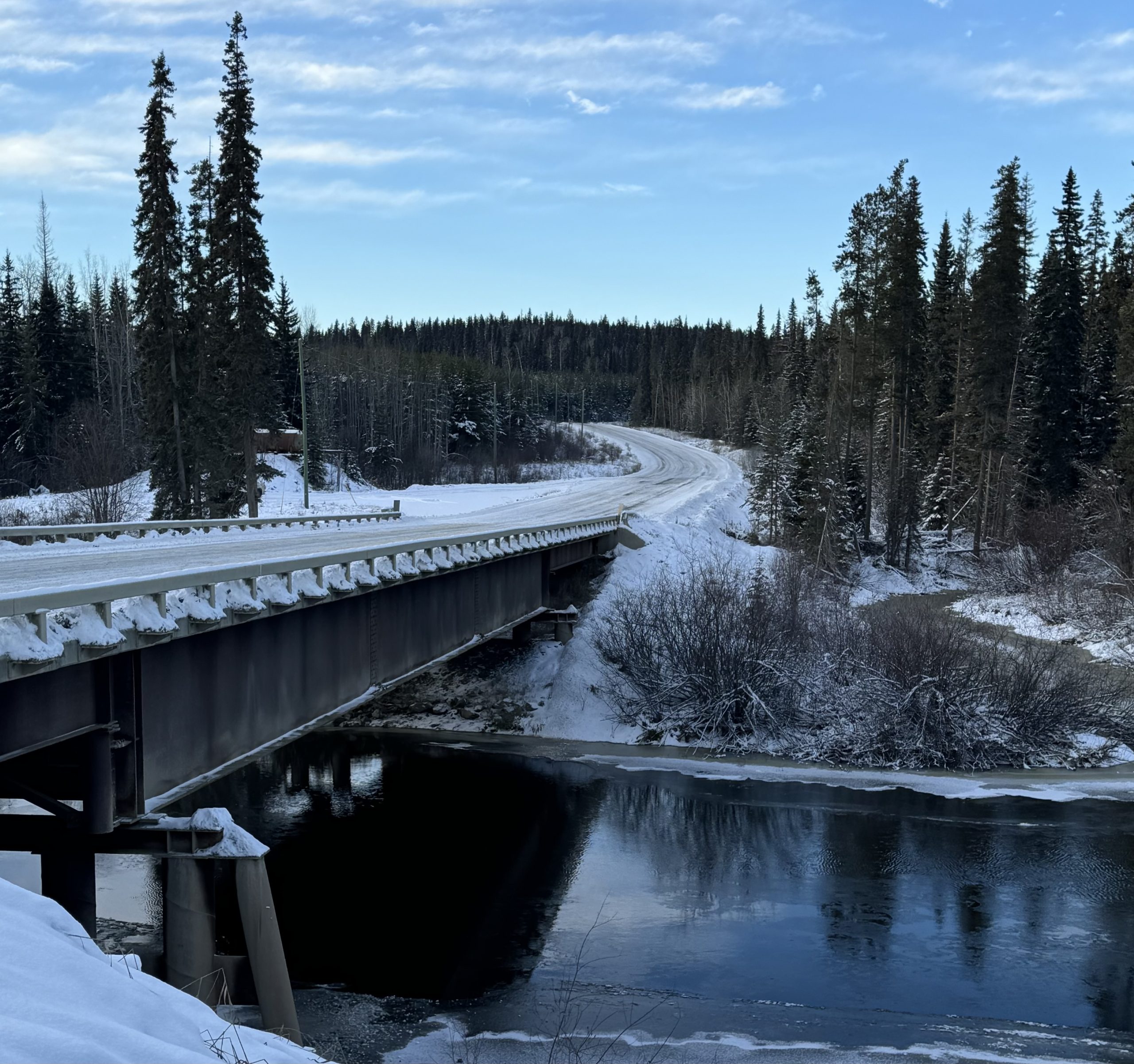
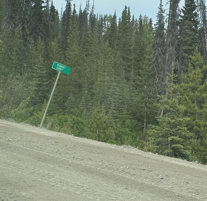
The Takla Nation territory in North Central British Columbia is a landscape where land, water, and people remain closely connected. Rivers shape travel routes, wetlands support cultural harvesting areas, and forest service roads (FSRs) provide essential access across vast forested watersheds. These roads connect communities to cultural sites, forestry operations, and emergency services, making them critical infrastructure in remote regions. Climate change is placing increasing pressure on these road networks. Heavy rainfall, earlier snowmelt, intensified freeze-thaw cycles, and prolonged dry periods accelerate erosion and strain drainage systems. When culverts fail or road embankments wash out, sections of the FSR network can become impassable, disrupting travel, emergency response, and access to harvesting areas. Understanding how climate change affects FSR infrastructure is therefore essential for both community resilience and watershed health.
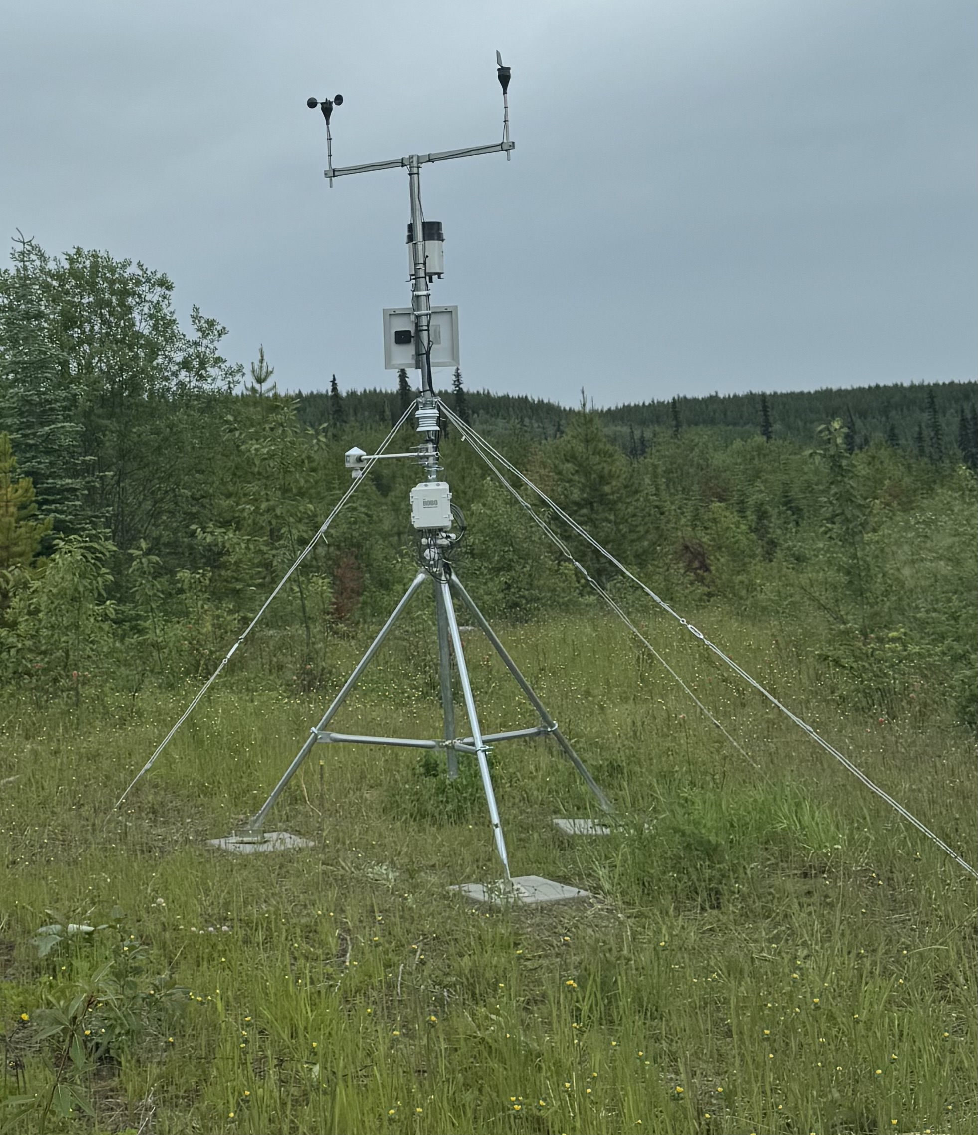
Addressing these risks requires collaboration among those who manage the roads, those who study the landscape, and the communities who rely on them. To better understand these changes, the B.C. Ministry of Forests, the University of Northern British Columbia, and the Takla Nation partnered to examine climate-related vulnerabilities partnered along forest service roads in the region. Ministry engineers have remained actively involved through regular project meetings, field coordination, and technical discussions that connect research findings with real-world road management challenges. The ministry has also supported the work by funding monitoring equipment, including a climate station that tracks rainfall, temperature, and seasonal conditions influencing road stability.
I am a hydrologist trained in cold-region flow processes and climate-driven landscape change. My research focuses on understanding how water movement, erosion, and changing climate conditions influence infrastructure and watershed systems. Working with the Takla Nation and the B.C. Ministry of Forests has expanded this work beyond technical analysis alone. Climate adaptation along FSR networks requires partnerships that combine hydrologic science, engineering practice, and community Knowledge of the land.
This project investigates how climate change affects forest service roads, stream crossings, and the ecosystems they intersect. By combining environmental monitoring with community observations, the research aims to support locally informed adaptation strategies that strengthen both road resilience and watershed stewardship.
The study was developed around three guiding goals:
- Identifying vulnerable sites through integrated mapping
Using GIS tools, hydrologic models, and elevation data, we examined areas where rainfall, slope conditions, and drainage patterns interact to create risk. Climate science shows that storm intensity in northern B.C. is increasing, leading to flashier runoff and greater erosion. By combining these datasets with local Knowledge of problematic crossings, we could pinpoint locations where even small changes in weather could trigger road failures. - Incorporating Traditional Ecological Knowledge (TEK) into assessment
TEK provided insights that could not be obtained from models alone. Community members described how certain streams behave differently depending on the quality of snowpack, where fish congregate during high-flow periods, and how the health of vegetation can signal changes in groundwater levels. These observations guided our site visits, helped us interpret hydrological anomalies, and ensured that the assessment reflected the lived experiences of those who use and steward the land. - Designing adaptation measures rooted in both science and cultural values
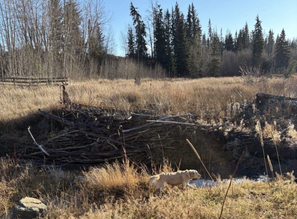
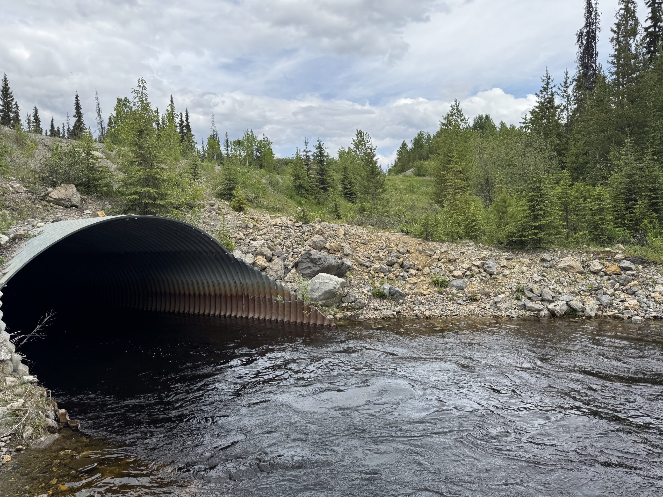
Potential solutions include enhancing culverts, stabilizing slopes, re-planting riparian vegetation, and exploring nature-based approaches such as beaver dam analogues (BDAs). BDAs reflect an understanding shared across both TEK and ecology: beavers are natural engineers that slow runoff, spread water across floodplains, and help maintain stream health. These measures aim to protect roads while also supporting fish habitat, water quality, and ecosystem resilience.
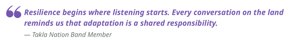
This combination of Western scientific methods and place-based Indigenous Knowledges strengthened our understanding. In many cases, what instruments recorded echoed what Takla members had described long before we arrived: that certain hillsides thaw earlier each year, that particular creeks run louder just before they overtop the road, or that fish move differently when channels shift after heavy rains. Taken together, these observations told us that the land is actively signaling change.
Tying into the
BC First Nations Climate Strategy
This project aligns closely with the BC First Nations Climate Strategy and Action Plan, which emphasizes that climate adaptation must be grounded in community leadership, cultural teachings, and respect for the land. Several of the Strategy’s core principles have guided the work from the outset.
Respect and Reciprocity:
Project decisions are shaped by the Takla Nation’s values, priorities, and ecological teachings. This means listening to community perspectives on road safety, fish habitat, and watershed changes, and ensuring that research activities support, rather than override local stewardship practices. Reciprocity is reflected in how knowledge is shared back with the community through meetings, mapping tools, and collaborative planning sessions.
Resilience through Restoration:
Rather than focusing solely on structural fixes, the project seeks to incorporate natural processes into the solution. Beaver activity, for example, is increasingly recognized in both Western ecology and Indigenous Knowledges as a powerful contributor to watershed resilience. Beavers slow down water, reduce peak flows, and create habitats that benefit multiple species. Riparian vegetation offers similar benefits, stabilizing banks and improving water quality. By designing adaptation measures such as beaver dam analogues, culvert upgrades, or targeted re-vegetation, the project works with, rather than against, ecological functions.
Equity in Adaptation:
Reliable road access is essential for community health, cultural activities, and emergency response. The Strategy highlights that adaptation must support the well-being of all community members, especially those in remote regions where infrastructure failures carry significant consequences. Understanding where risks occur and how they affect daily life helps ensure that adaptation planning is both fair and responsive.
This approach also contributes to the goals of the BC Action Plan for Disaster Risk Reduction, which calls for stronger communication, coordination, and shared learning across all sectors involved in managing hazards. By bringing together community stewards, ministry engineers, university researchers, and environmental monitors, the project builds a collective understanding of where the landscape is changing and what actions may reduce long-term risk. Each partner brings a unique perspective, including hydrology, road design, cultural relationships with the land, and long-term observations passed down through families.

Adapting to climate change requires teamwork across disciplines and across worldviews. In practice, this means more than occasional meetings. The group meets regularly to examine new data, compare field notes, and refine the assessment of vulnerability. Hydrologists might present updated flow models; community members may describe how a stream behaved during a recent storm; engineers consider what designs could work in steep, icy, or permafrost-influenced terrain.
To ensure the work remains transparent and useful, key findings are shared through interactive GIS dashboards, plain-language summaries, and community discussions at Takla Landing. These tools help make science accessible, allowing community members to explore information at their own pace. By creating shared spaces for interpretation and decision-making, the project supports climate adaptation that is grounded in place, strengthened by collaboration, and guided by the principle that resilience grows when people and knowledge systems work together.
LEarning through
Partnership
From the beginning, the Takla Nation leadership and environmental monitors shaped the project’s direction. They identified priority areas of concern, shared long-standing observations about water, wildlife, and weather, and guided our fieldwork on the land. Their teachings, how snow behaves differently on various slopes, how a stream sounds before it overflows a road, and how culturally important areas respond to seasonal change, helped us understand vulnerabilities that would not be apparent in models alone. In turn, our team provided hydrologic tools, mapping capacity, and monitoring equipment to support community stewardship efforts.
Through this partnership, we have learned that resilient road networks must work with natural systems rather than against them. Measures such as enhanced culverts, re-vegetation, beaver dam analogues, and seasonal monitoring can protect infrastructure while also supporting fish habitat and watershed health. Co-developing these solutions strengthens relationships, builds trust, and creates shared ownership of climate adaptation planning.
This case study reflects on what it means to conduct research ethically and reciprocally, with the land, with communities, and with institutions that seek to bridge Western scientific methods with Indigenous Knowledges and stewardship. By walking this path together, we aim to contribute not only to safer roads but also to stronger partnerships and more resilient futures.
Learning from
the roads
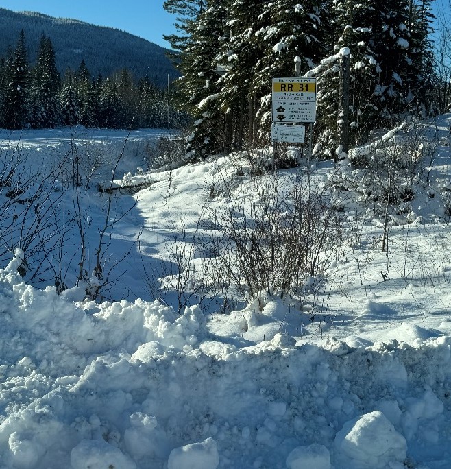
Spending time on the land quickly changed my understanding of the project. Fieldwork in Takla territory revealed how quickly conditions can shift and how these changes influence travel and safety along forest service roads. Cell service disappears soon after leaving the nearest community, making planning and communication essential.
Seasonal conditions further complicate travel. In summer, extended dry periods fill the roads with dust, reducing visibility when logging trucks pass. In winter, snow and ice accumulate along shaded curves, creating hazardous driving conditions. On one trip our vehicle slid into a ditch hidden beneath fresh snow. With no phone signal, we relied on passing drivers until a police officer stopped and ensured we were safe while a snowplow operator helped tow the vehicle back onto the road.
Despite the challenges, what stood out most during these trips was the generosity of the people we met. On a winter day when we needed a tow but couldn’t pay immediately because there was no signal, the driver simply said, “That’s fine. We can settle it when you get service.” The trust in that gesture stayed with me. The same officer who helped us also checked in again later to make sure we made it home safely. These acts reflect the strength of community in remote regions and the importance of looking out for one another.

Experiences like these shaped how I approach this research. They reminded me that climate adaptation is not only about culverts, slopes, or hydrologic models. It is about people, relationships, and the knowledge that comes from living on the land year after year. The project is stronger because it is guided by community priorities, supported by local expertise, and grounded in the realities we witnessed together.
Learning from both
Land and water
Central to the project is a shift in perspective that guides how we study climate vulnerability along forest service roads. Rather than viewing roads as separate from the waterways they cross, we understand them as part of the watershed itself. Every culvert upgrade, drainage improvement, and vegetation treatment becomes a decision about how water moves through the landscape.
From the beginning, the Takla Nation guided the process in meaningful ways. Early conversations with community leaders helped establish priorities grounded in local concerns. Fieldwork then built on this foundation. Takla environmental monitors, trained in drone operations, GPS, and hydrologic observation, played key roles in data collection and site interpretation. Their Knowledge shaped where we went, what we looked for, and how we understood the land’s response to seasonal change.
For university researchers, these field days became opportunities for mutual learning and knowledge exchange. We practiced reading the landscape in new ways, noticing how snow lingers on north-facing slopes, how certain plants indicate changes in soil moisture, and how the sound of water can reveal whether a channel is beginning to rise. These subtle indicators, well understood within Takla Knowledge systems, helped refine our hydrologic assessments and build a more holistic understanding of road vulnerability.
Key Insights
From the project
This project has shown that reciprocal research is a relationship built over time. Shared decision-making, mutual learning, and flexibility have shaped how the work evolves. Several insights have emerged that continue to guide the project.
- Start with community priorities. Before any model was run or any instrument installed, we listened. Community members identified crossings that fail repeatedly, slopes that thaw unpredictably, and areas where cultural access is threatened during storms. These insights grounded the technical work and helped ensure that our assessments addressed real-world concerns rather than hypothetical scenarios.
- Respect multiple knowledge systems. Western hydrology, climate science, and engineering offer valuable tools, but they cannot replace long-term observations held within the community. Traditional Ecological Knowledge (TEK) has pointed us to places where streams behave differently after early melt, where fish avoid certain channels later in the season, or where vegetation changes signal deeper shifts in groundwater levels. When scientific data and TEK are brought together, each strengthens the other, creating a fuller picture of the landscape.
- Recognize how roads influence watersheds. Traveling the FSRs taught us that the road itself can become a source of environmental risk. Dust from long dry periods settles on slopes and, after rain, washes into nearby streams. These fine sediments can harm spawning beds and reduce water quality. Seeing this firsthand reinforced the need to address road resilience and ecosystem health together. Measures such as improved ditching, vegetation buffers, or more frequent grading are not just engineering tasks; they are essential to protecting fish habitat and maintaining overall watershed integrity.
- Field safety is lived knowledge, not just a training module. Remote work brings lessons that no online course can fully prepare someone for. The realities of uneven driving surfaces, deep ruts, mosquitoes, wildlife encounters, sudden weather shifts, and long stretches without communication require judgment, preparation, and experience. These insights are invaluable for students and early-career researchers. Teaching field survival skills, such as how to read changing conditions, when to turn back, how to manage fatigue, or how to plan safe travel on FSRs, is essential to keeping people safe and confident on the land.
- Share ownership of results. Every map, model output, and field finding has been developed with the intention of returning the knowledge to the community. Tools are co-designed so that Takla environmental monitors, forestry staff, and local leaders can use them independently. Reciprocity means that the work continues to serve the community long after the research phase is complete.
Epilogue
Continuing the work:
Climate adaptation as a long term commitment
Climate adaptation is not a task completed in a single season. Watersheds evolve gradually and sometimes unexpectedly as climate patterns shift. Freeze-thaw cycles vary each year, and roads that appear stable one spring may face new challenges the next.
Fieldwork has demonstrated the unpredictability of working in remote northern landscapes. Wildlife interactions, shifting weather, and difficult travel conditions are part of conducting research in these environments. These experiences remind us that adaptation requires patience, flexibility, and respect for the land.
As monitoring continues, new observations will strengthen our understanding of rainfall, snowmelt, and runoff patterns affecting forest service roads. Over time, these insights will support improved infrastructure planning and watershed stewardship.
Climate adaptation is a journey rather than a fixed destination. The challenges we face, ranging from changing weather patterns to wildlife interactions and road safety concerns, underscore the importance of collaborative research. As a lifelong learner guided by the land’s original stewards, I recognize that this work requires humility, reciprocity, and a sustained commitment to continual learning. Moving forward, I will carry these principles into every stage of the project to ensure the research remains accountable, respectful, and responsive to the community and the land.
Dr. Guowei Li is a Postdoctoral Fellow at the University of Northern British Columbia, and a recipient of a PICS Uplifting Reciprocal Research Scholarship.
