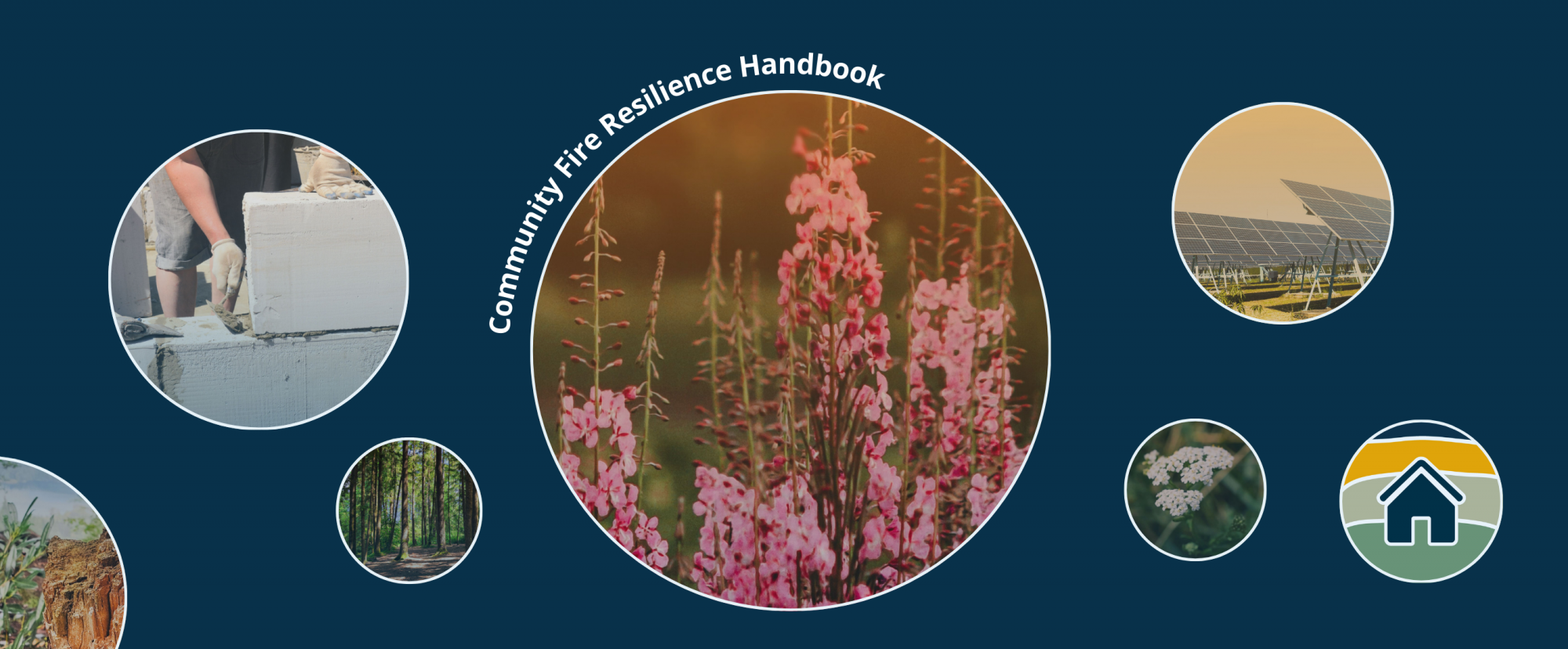
B.C.’s rural and remote communities are facing more frequent forest and urban-interface fires. These areas may not have the same resources and infrastructure as urban centres to respond effectively. Fire activity is expected to increase, making preparation more important than ever. Housing, wellness, community resilience, community and Indigenous self-determination, and emergency planning are all substantial concerns. Despite these challenges, with the right tools and resources, there are practical and accessible ways for everyone in a community to build their home’s fire resiliency.
This handbook aims to support community fire resilience. It provides information and resources to get the whole community – from children to Elders – involved in fire-resilient practices and planning.
About the Handbook
Author
This page is part of a PICS-funded project, Building Climate Resilience in Rural & Remote Communities. The project is centred around collaborations that bridge climate strategies and policies in British Columbia with Indigenous and community-driven expertise. It focuses on low-carbon resilience in housing, technical systems, and community planning.
Research Partner
As a step towards Indigenous self- governance, the First Nations Housing and Infrastructure Council (FNHIC) delivers housing and infrastructure programs for First Nations in B.C. They provide comprehensive services that promote self- determination, organizational growth, and transformation, ensuring that no First Nation is left behind.
Acknowledgements
The project team would like to thank the following people for their guidance and support in completing this project:
- The many attendees of our webinar series and focus groups, who saw this project come into reality and offered feedback along the way.
- Gil Davies, West Moberly First Nations building manager, and West Moberly Chief and Council, who contributed so thoroughly through their comments, advice, and consistent participation in our workshops.
- James Bourget (RDH Building Science) for imparting his knowledge and guidance on fire resilient building materials at our webinars.
- Niki Lindstrom for her dedication as a collaborator and champion on this project.
- Patrick Michell (Nlaka’pamux Nation Elder; former Rebuild Director for Lytton First Nation) for his willingness to share his support, guidance, and knowledge.
The Fire Resilient Communities Handbook would not be the tool that it is today without the contributions, kindness, and expertise of those who collaborated and contributed to this project. Thank you.

Defining Resilience
Fire resilience is distinct to each community, meaning every community may need distinct supports and tools to support their resilience. A community’s infrastructure, residents, capacity, and values will all influence fire resilience.
The handbook aims to:
- Be engaging for everyone, at every age.
- Serve as a resource guide for housing, maintenance, capital, infrastructure and other managers, residents, and homeowners.
- Provide practical information on fire mitigation strategies.
- Be a source of capacity-building ideas, activities, and programs for communities.
This handbook is grounded in the principle of building resilience for future generations, drawing on the knowledge and experiences of the generations who came before us. Building fire-resilient communities for future generations should be rooted in past, present, and future innovations. The resources in this guide aim to acknowledge and honour Indigenous knowledges, building styles, and governance systems.
Resilience facilitates recovery, empowering individuals to support each other and strengthen their community’s capacity.
Wheel of Community Fire Resilience
Community fire resilience begins with systems of shared responsibility. Every generation plays a role, and by working collectively, communities can create holistic systems that protect the intersecting risks associated with fire.
Community resilience includes practices that are embedded into many aspects of community life, governance, and planning. As a result, community resilience is interwoven with other risks, concerns, and the wellbeing of the community. The Fire Resilience Wheel aims to capture these related topics. It can be customised to more precisely represent individual communities and Nations’ priorities.
The inner segments of the wheel represent broad, overlapping aspects of fire resilience. The outer segments are examples of those broad categories and were chosen through community engagement sessions. They are not exhaustive.
Other groups have previously used wheels as a framework for understanding community fire resilience. For example, see the work of the Fire Adapted Learning Communities Network, a separate US-based organisation that supports connections between communities working on wildfire resilience.
📄: Wheel of Fire Resilience
Download the PDF for printable, customisable wheels.
Handbook Chapters
Community Planning Toolkit
Practical resources and tools to support community and household-level planning & fire preparedness.
Fire Primer
Information on how fires spread and home ignition zones.
Air Quality
Information and resources about the effect of increased wildfires on air quality
Housing & Building Materials
Guides on designing, building, or retrofitting fire-resilient infrastructure.
Capacity Building Resources
Funding community fire resilience
Community Planning Toolkit
This section provides resources to help both households and communities prepare for fires.
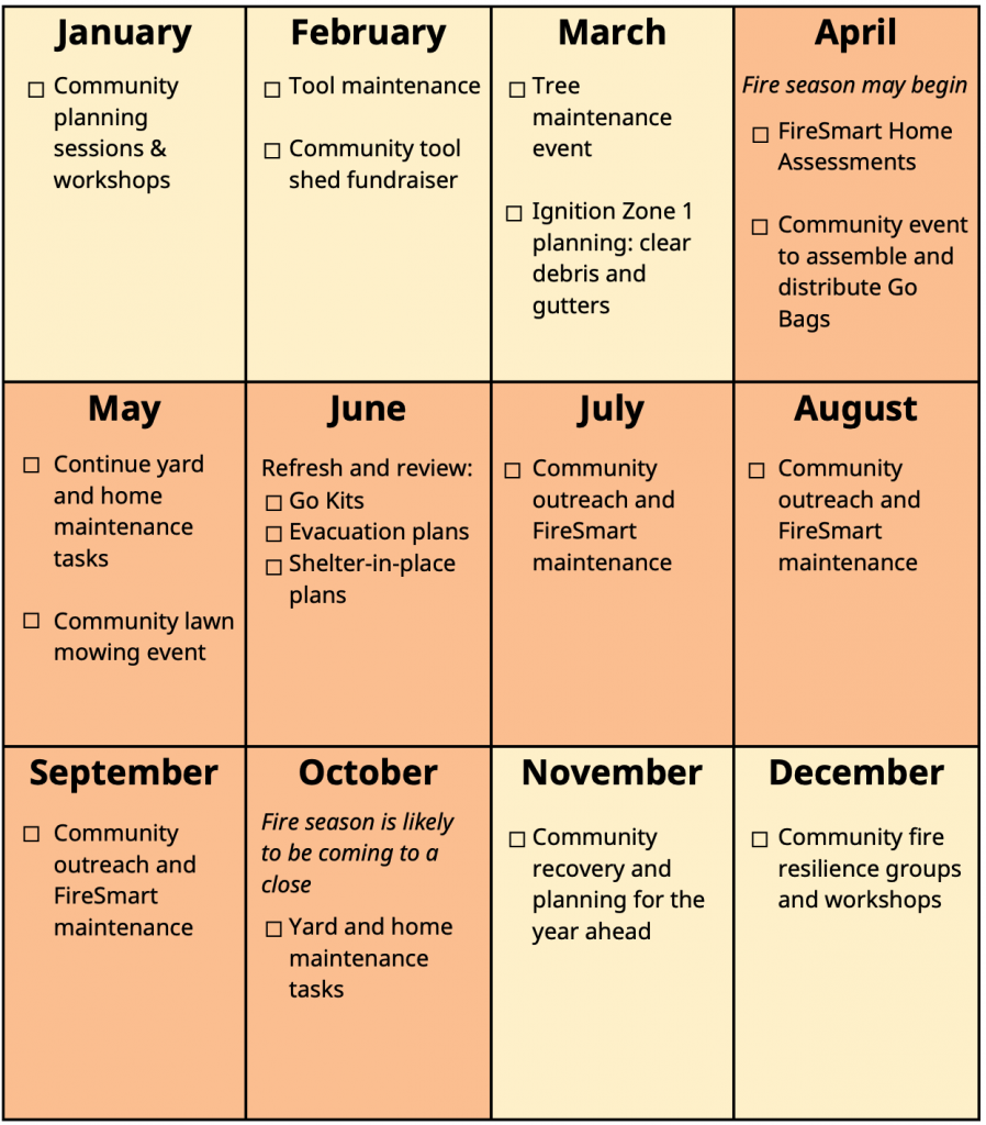
British Columbia Fire Resilience Calendar
Before, during, and after fire season, communities can plan for fire resilience and host events that promote fire preparedness at the household scale. The following calendar provides suggestions for important dates and potential community events to promote engagement in fire safety planning. These are examples. Every community will differ in seasonality, landscape, planning, and resources. FireSmartTM practices should be maintained year-round.
Contact Sheet
Collecting key contacts ahead of time can aid in rapid response to fires. As applicable, have the contacts for the following individuals/groups available:
- Fire Department;
- Housing Manager;
- Emergency Services;
- Fire Resilience Steward (a community leader who promotes fire resilience and supports fire preparedness activities);
- Personal emergency contact(s).
The contact sheets from the handbook can be printed to fill by hand or filled out using a PDF viewer. You could also save these contacts on your phone if possible.
Note: to print out the contact sheet at the correct size, set the Scale (%) in the print settings to ‘Actual’ instead of ‘Fit to Printable Area’
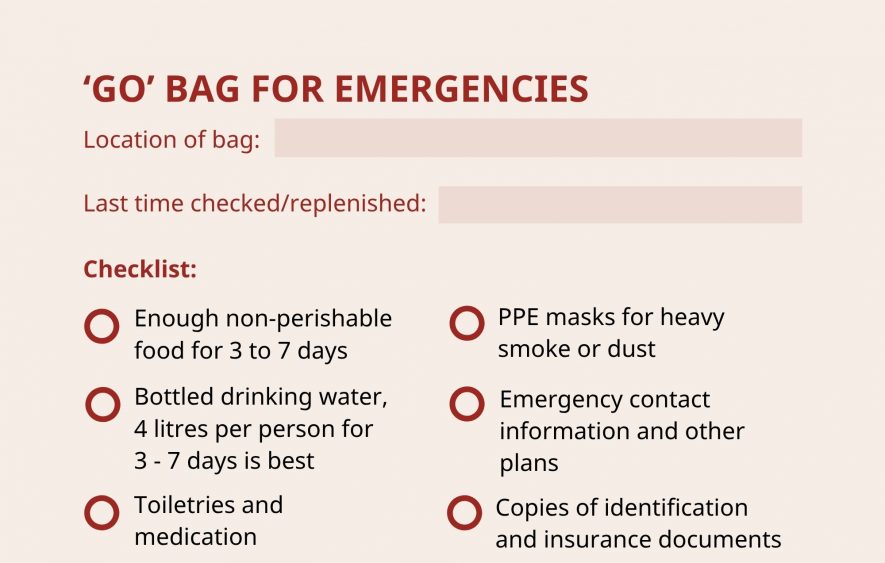
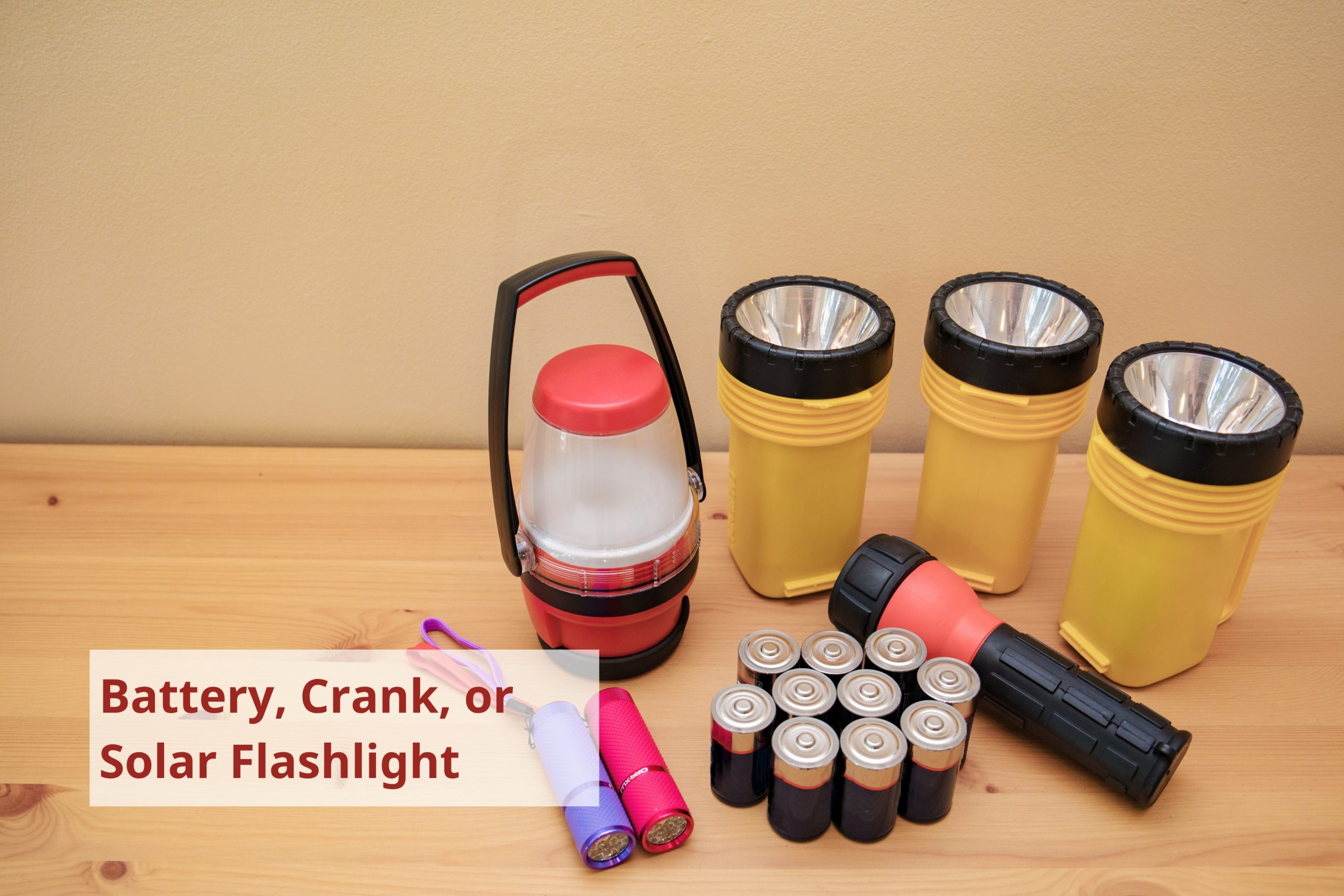
‘Go’ Bag
Useful for more than just fires, a ‘go’ bag is a collection of supplies a household keeps ready in a portable kit in case of emergency. They can save time and stress in case of an urgent need to evacuate. Even if you do not have the means or space for a dedicated bag of separate items, being aware of where these items are in your living space can make evacuations more efficient.
In addition to the general list of items below, go bags should be adapted to fit a household’s health, cultural, and personal needs. As examples:
- Identification may include a passport, driver’s license, health card, birth certificate, permanent resident card, visa, and/or status card.
- The First Nations Health Authority’s example kit, made by their Vancouver Coastal Health Emergency Management Team, includes Sḵwx̱wú7mesh Úxwumixw (Squamish) canned sockeye salmon, plant medicines, and a sage & cedar bundle. Different nations may have culturally significant plants and/or medications that could be included in a kit.
Fire Preparedness Tip: In addition to packing supplies, Technical Safety BC has information on preparations you should consider for electrical and gas safety. Unplugging non-essential electrical appliances, turning off valves, shutting off the water, and clearing combustible material near propane storage tanks can minimise the impact of fires. If your natural gas is supplied by Fortis BC or Pacific Northern Gas, do not shut off your natural gas. If you are on propane or your gas is supplied by another entity, shut of the main gas supply.
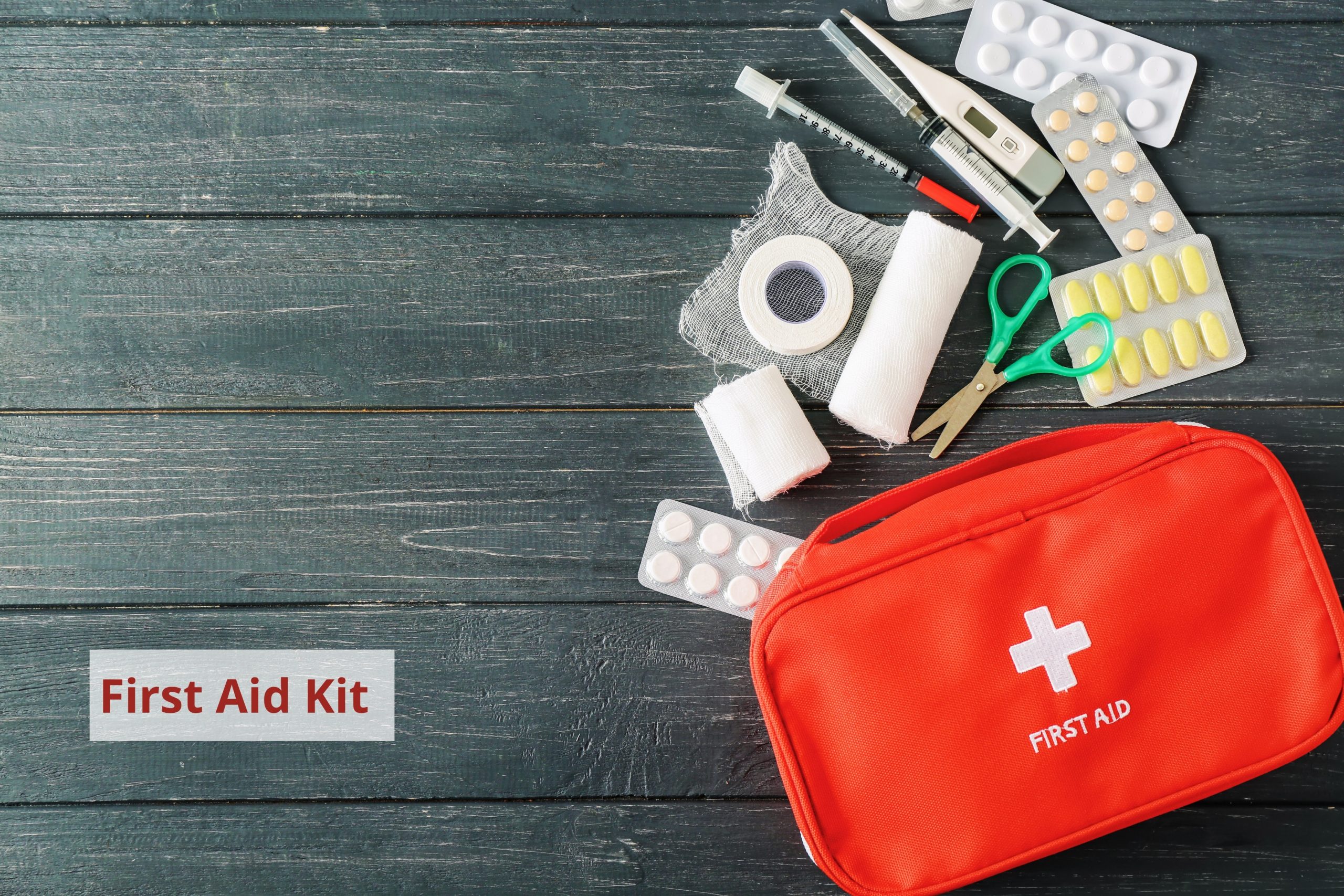
Emergency Preparedness Kits
It may not always be possible or desirable to evacuate. Emergency preparedness kits will have many of the same items as a go bag, but are intended for sheltering in place during an emergency situation. In addition to the items in a go bag, they should include:
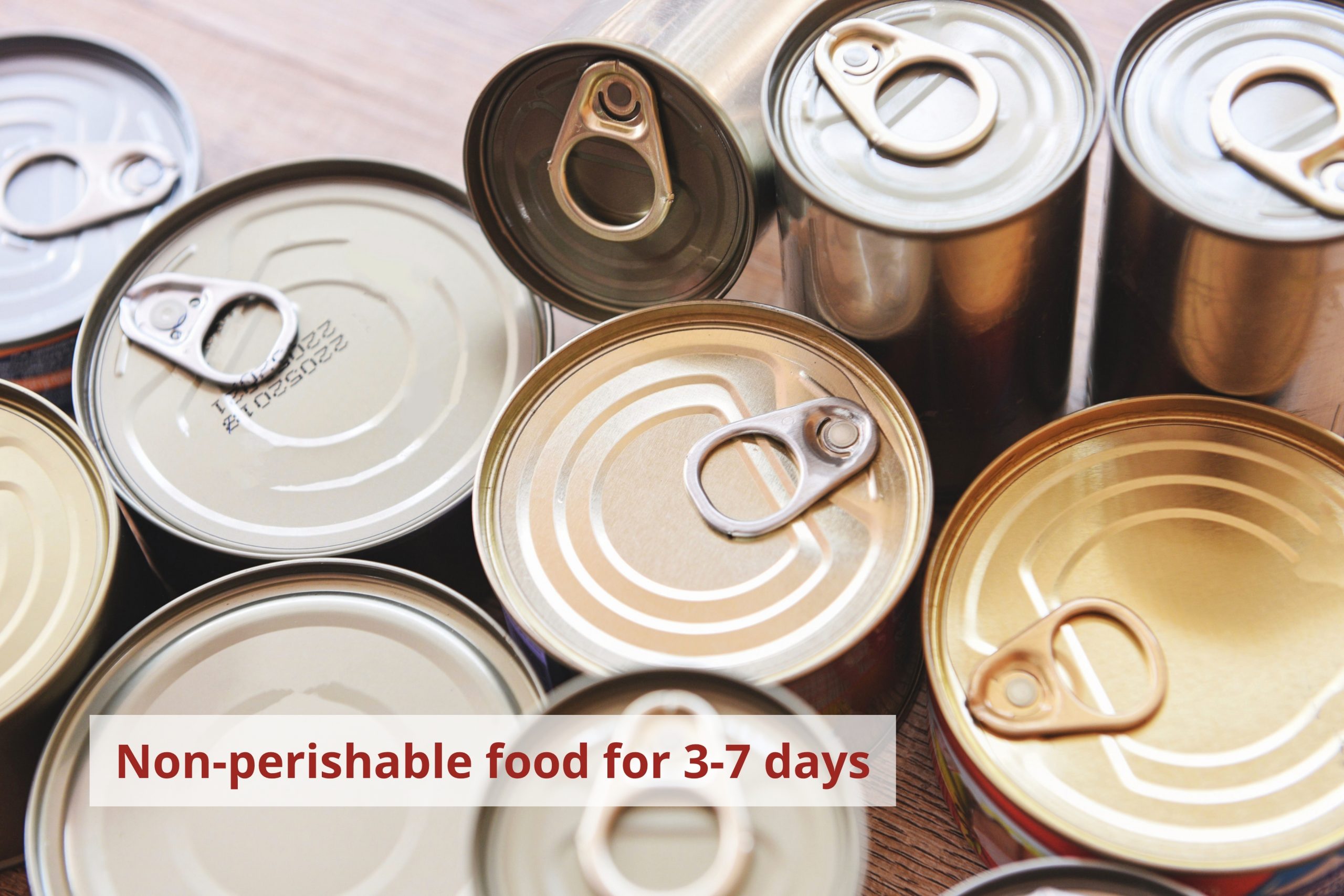
- Food for at least three days. In remote areas with limited access and exit routes, food for 7-10 days is ideal.
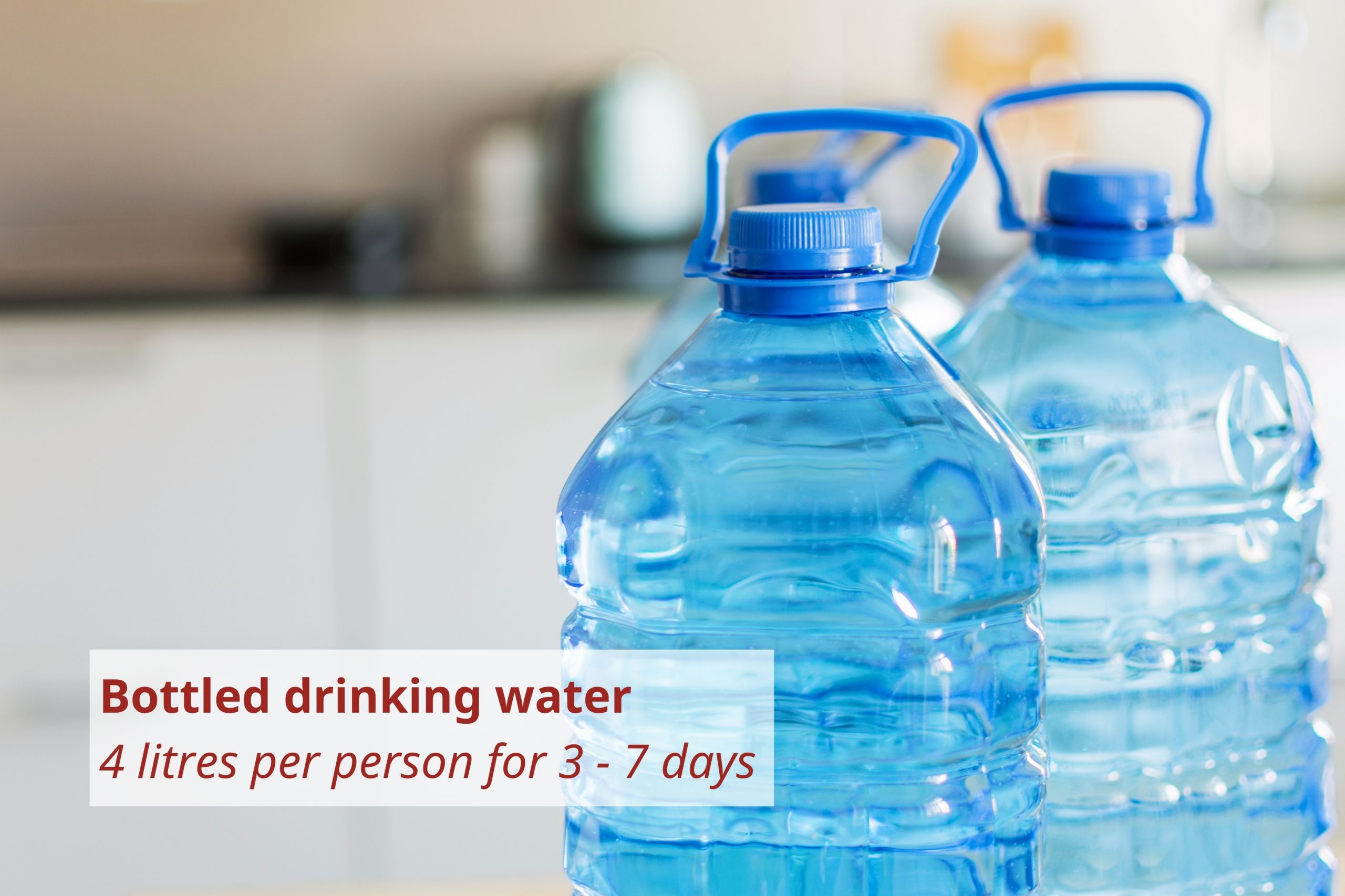
- A one-week supply of water, which should be replaced once a year.
- Garbage bags and towelettes.
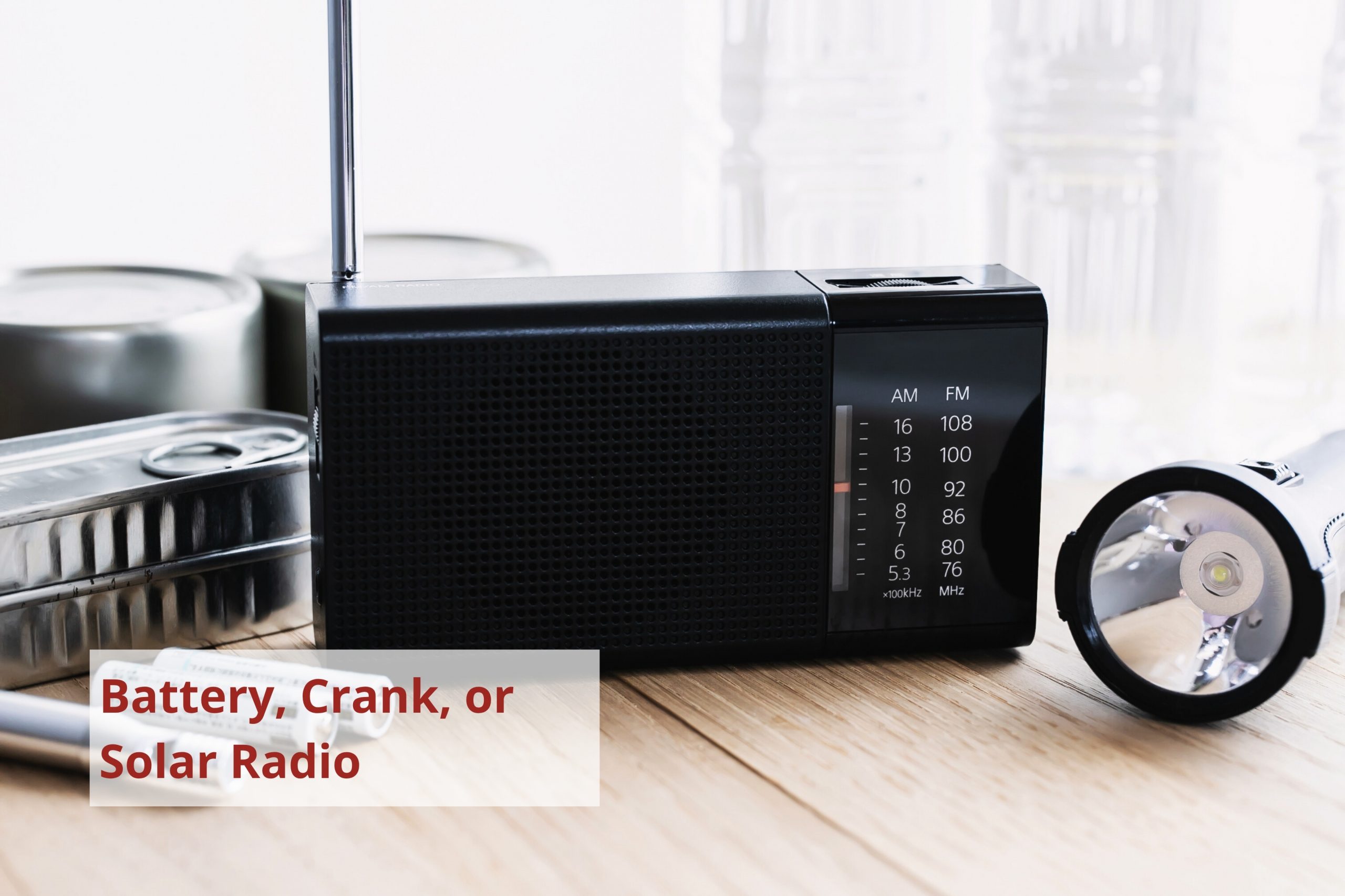
- Lantern and fuel for light. Be sure that any fuel is stored outside and away from a heat source.
- Bush cooking stove for cooking outside. Be sure that any fuel is stored outside and away from a heat source.
Supply lists for kits have been produced by the Government of BC and the Red Cross (page 11 of the PDF). You may need additional supplies if you keep animals or have specialised equipment or tools with maintenance needs.
Fire Preparedness Tip: Once you’ve put together your kits, it’s important to check on them regularly. You’ll want to ensure that any perishables haven’t spoiled, that all equipment still works (e.g., you may need to replace old batteries), and that your information is up-to-date. Set yourself a reminder on your calendar if you use one!


Community Tool Sheds
Enacting fire resilient strategies often requires access to physical tools. A community tool shed, or tool library, can provide community members with access to tools they might not otherwise have, which can help everyone maintain a fire resilient community. Community tool sheds often operate like a library, with sign out sheets and membership cards to keep track of shared tools. They may come from collaborations with the local public library, community center, or through grassroots initiative.
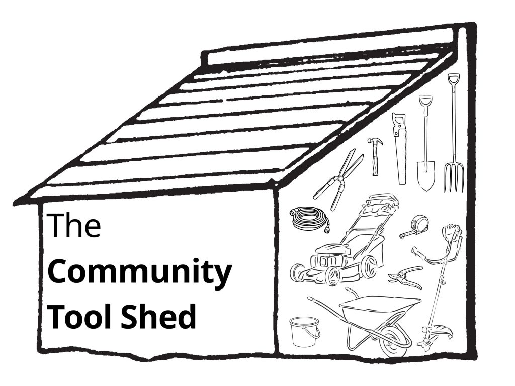
Potential items that might be in a community shed include:
- Buckets
- Gardening or hedge clippers
- Lawn mowers and grass trimmers
- Rakes
- Shovels
- Wheelbarrows
The Toronto Tool Library is an excellent example of a potential model for a community tool shed.
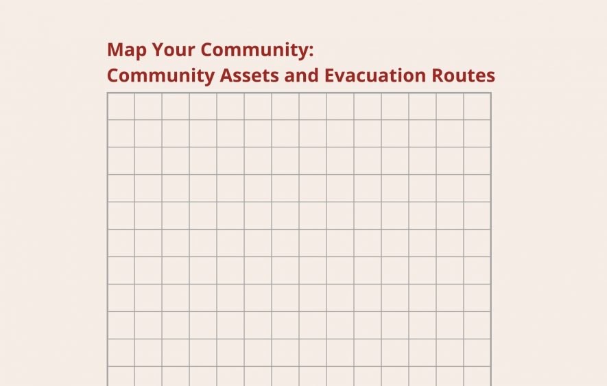
Map Your Community: Community Assets and Evacuation Routes
Community Asset Mapping
When planning for emergencies, an inventory of critical infrastructure can be useful to identify coordinated evacuation points, potential hubs for emergency services, and which buildings should be prioritised when funding upgrades for climate resilience. For example, critical infrastructure buildings might be the first to receive formal FireSmart assessments.
Which locations are identified as critical infrastructure is community-dependent and should be informed by community values and priorities. Potential critical infrastructure types include:
- Animal welfare shelters;
- Cultural, community, and recreation centres;
- Fire halls;
- Halls or other large gathering places;
- Libraries;
- Museums and archives;
- Operations centres;
- Schools and other educational facilities;
- Youth centres and preschools;
Evacuation Routes
Fires may require communities to evacuate quickly and on very short notice. Mapping out potential evacuation routes ahead of time can aid with safe and lower-stress evacuations.
Steps to mapping your community:
- Grab a blank or grid piece of paper. You could also print/annotate a conventional reference map of your community if you have one handy.
- Start with key landmarks that are important to you, such as your home, key landscape features like a river or mountain etc., and add them to your map.
- Next, identify fire halls, cooling centres, and/or safe shelter sites that you might evacuate to in the event of a fire.
- Identify the location of exit points (i.e., the start of the highway or another road out of town).
- Some areas within a community may be more vulnerable to fire than others i.e., if they have an abundance of dry, uncleared vegetation that could serve as fuel for a fire. Identify these areas to ensure your evacuation routes avoid them whenever possible, as they may be blocked off or other inaccessible in the event of a fire.
- Based on the location of your home and key sites for potential evacuation, determine and draw out viable, safe evacuation routes.
Keep your map easily accessible (perhaps in your go-bag!) in case of evacuation.
This exercise might also reveal areas where community planning could reduce the vulnerability of community assets and infrastructures (i.e., through hosting regular vegetation clearing events or other fire preparedness tasks).
Fire Preparedness Tip: If you have animals in your care (horses, chickens, livestock etc.), you may want to consider special arrangements for their relocation. Some regional districts have emergency plans for livestock (e.g., Alberni-Clayoquot Regional District’s emergency plan for farms, the Regional District of Bulkley-Nechako’s resources) that may be applicable or helpful when planning for non-commercial animals. Additionally, registering for a Premises ID with the provincial government allows emergency responders to properly document who to reach out to during emergencies.
Map Your Community: The Fire Resilient Map
Communities all over the province are engaging in fire preparedness activities. Share stories about places in your community that contribute to fire resilience by adding a pin to The Fire Resilient Map.
Responses are moderated and may not appear immediately after submission. Please ensure that you have permission to share any stories you post to the map.
Some of these submissions are from British Columbia FireSmart’s Success Stories.
Other Community Planning Resources
The following resources are not produced or maintained by the project.
Three Features of a Wildfire-Ready Community
Intact Centre on Climate Adaptation at the University of Waterloo (2023)
This one-page document provides three ways to plan a wildfire-resilient community through protecting structures, designing the community to reduce risk, and proactively designing emergency responses.
Wildland Urban Interface Community Preparedness Digital Tool
National Indigenous Fire Safety Council (2023)
This tool identifies 18 community roles and/or groups who have a part to play in wildfire preparedness, outlining what they should do before, during, and after a wildfire. Each role is represented by an icon designed by Anishinaabe Onyota’a:aka artist Tsista Kennedy.
The recommendations within the tool are based on a report from the University of Waterloo.
The Fires Awakened Us – Wildfire Report
Jocelyn Stacey, Crystal Verhaeghe, and Emma Feltes, produced for the Tŝilhqot’in Nation (2019)
This report reflects on the Tŝilhqot’in Nation’s experiences of the 2017 wildfire season. As shared by the Nation’s Tribal Chairman, Nitsil’in Joe Alphonse, “we hope this report can be used to improve emergency management in other First Nation communities while also maintaining their rightful jurisdiction”. Community planners may find the calls to action on pages 12 to 20 of the document particularly useful.
Wildfires? Here’s what you need to know about electrical and gas safety
Technical Safety BC (2021)
This short blog post provides guidance for homeowners and businesses to maintain electrical and gas safety if you are on evacuation alert or evacuation order. There are also precautions to take when returning home after an evacuation.
Fire Primer
Understanding how fires spread across a landscape helps communities determine how best to mitigate wildfire risk to community infrastructure and homes.
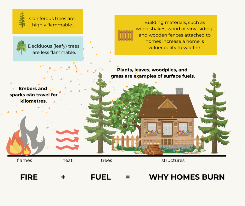
How do fires spread?
When forest fires reach residential areas, they become interface fires. Mitigating the spread of interface fires is best done through community planning, home and yard maintenance, and following FireSmart practices.
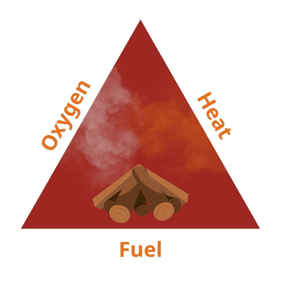
Fire Triangles
Fire requires fuel, heat, and oxygen to start and spread. By clearing surface fuels throughout communities and ladder fuels (vegetation that allows fires to climb from the floor to the tree canopy) against structures, the spread of interface fires can be mitigated. Fuels include anything that could catch fire: vegetation, firewood, wood chips, leaf piles, fuel tanks, and trees are all examples of fuels.
Fires can spread through:
Embers
Embers are burning debris carried by wind. They can travel up to 8 km.
Radiant Heat
Intense heat from a nearby fire can ignite a structure.
Direct Heat
Fire from a nearby structure or tree may transfer to a building directly.
Why does the fire triangle matter?
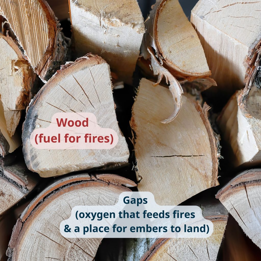
In many rural households, it’s common practice to store firewood against the exterior wall of the home. This can pose a fire risk because the combination of the wood (fuel) and gaps between logs (space for oxygen) can quickly ignite if an ember from a fire, even just a small campfire, falls into the gap. Decks with wooden boards that have more than a 3mm gap pose a similar hazard, especially if leaves and other dry matter that could fuel a fire are underneath the deck.
The other recommendations to mitigate fire spread in the following section also aim to minimise the potential of embers becoming larger, dangerous fires.
Home Ignition Zones
The home ignition zones start at the heart of the home and radiate out. Careful planning and maintenance for each zone can improve your home’s resilience to fire and mitigate spread. This section provides some suggestions of important tasks to maintain fire safety in each zone. Additional recommendations are provided by FireSmart Canada through the FireSmart Begins at Home Guide.
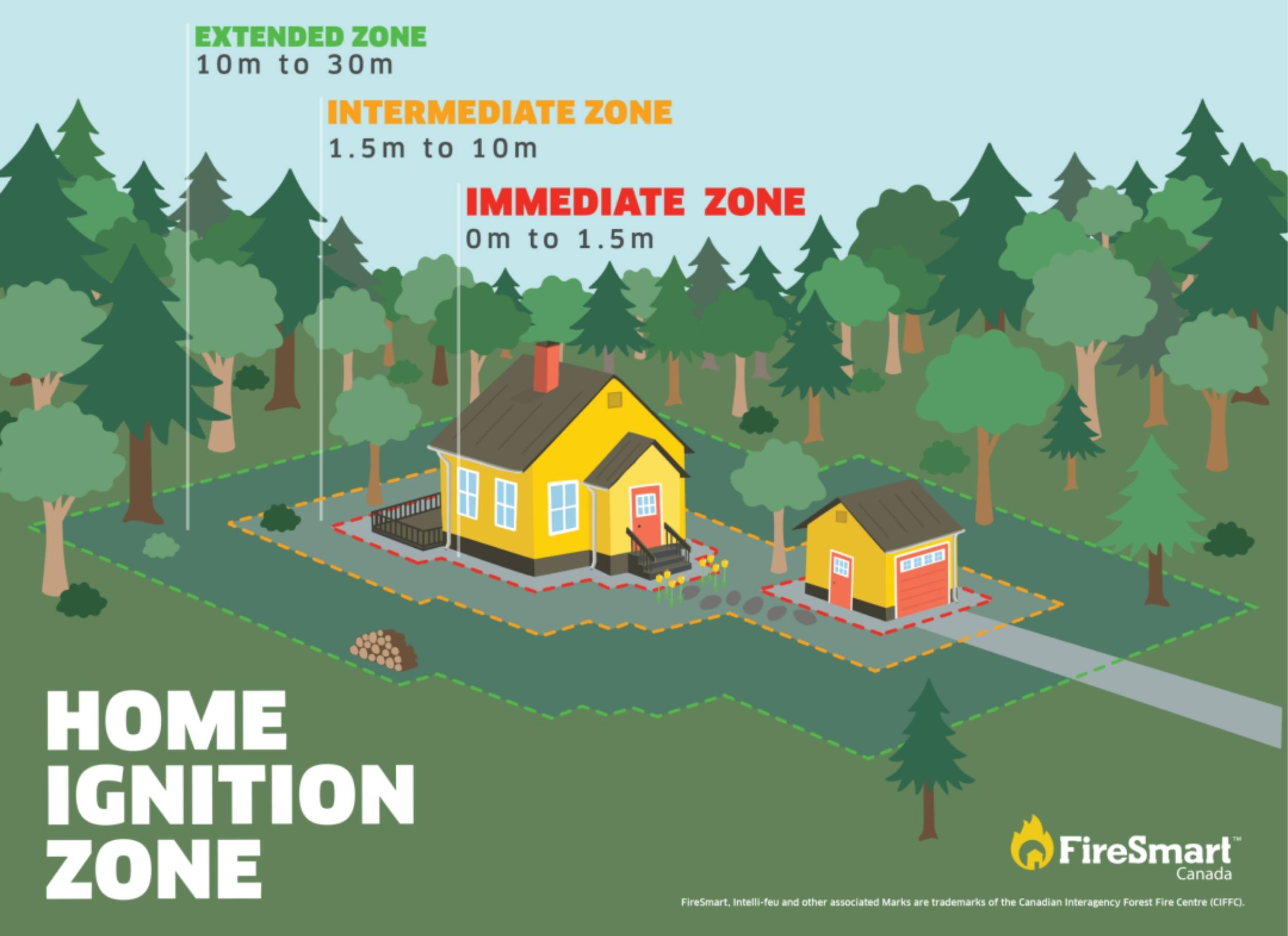
Learn more about each Home Ignition Zone and what to prioritize in each:
Immediate Zone: 0-1.5m
Priority: reduce the chance of ignition if an ember lands near your home by reducing fuel sources.
(1) Clear debris. Nothing should be stored against the house.
(2) Roofs and gutter cleaned and equipped with <3mm mesh.
(3) Chimneys equipped with spark arrestors.
(4) Decks cleared and free of gaps.
Intermediate Zone: 1.5-10m
Priority: manage the area to mitigate the risk of fire transmission to the home.
(1) Lawns mowed shorter than 10 cm.
(2) Foliage and trees tended from overgrowth.
(3) Fire resistant foliage and trees when possible.
(4) No placement of fuel tanks, firewood, or fire pits.
Extended Zone: 10-30m
Priority: reduce the intensity of any potential fires.
(1) Trees pruned and thinned from the bottom of the trunk up.
(2) Space trees 3m or more apart.
(3) Ensure safe and visible exits for emergency services in case of evacuation.
Plan collaboratively with neighbours to steward shared extended zones.
📄: Home Ignition Zone Colouring Page
Air Quality
Communities across British Columbia are finding practical and creative ways to protect themselves from wildfire smoke. From building your own portable air purifiers to establishing dedicated clean-air spaces in community gathering spaces, there are simple and cost-effective measures that you and your community can take to protect your well-being and health.
Air Quality Primer
Why does wildfire smoke matter?
Wildfire smoke can:
- Cause immediate and long-term adverse health effects.
- Travel long distances and can last for days to weeks.
- Infiltrate homes through cracks, vents, doors, windows, chimneys etc.
Among the many pollutants in wildfire smoke, tiny airborne particles called fine particulate matter (PM2.5) pose the greatest risk to human, animal, and plant health. These extremely small particles (smaller than 2.5 micrometers) can travel deep into the lungs and even enter the bloodstream.
Extensive research shows that PM2.5 can reduce lung function and cause serious health problems, including bronchitis, cognitive decline, heart failure, and premature death.
Who is most at risk?
There is no safe level of exposure to wildfire smoke. Even healthy adults risk adverse health effects after brief exposure.*
Those at higher risk may include:
- Older adults, infants, and pregnant individuals.
- Outdoor workers, athletes.
- Individuals living in rural or remote areas.
- Individuals with pre-existing heart, lung, or chronic health conditions.
- Individuals with lower socio-economic status (e.g. income, housing, education).
Learn more through the BC Centre for Disease Control (BCCDC).
*Brief exposure ranges depending on your health vulnerability and air quality levels.
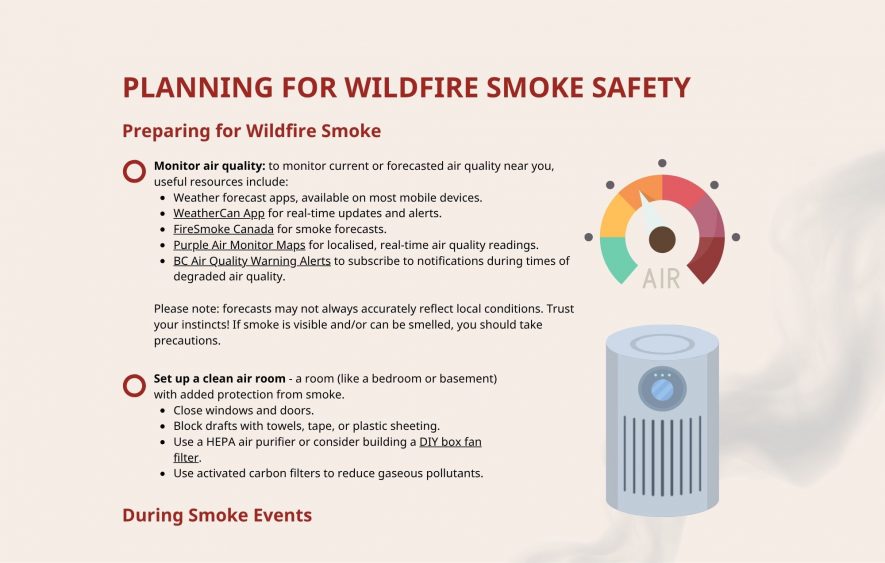
How do I monitor air quality?
Canada measures air quality with the Air Quality Health Index (AQHI). It measures overall health risk from a scale from 1 (low risk) to 10+ (very high risk).
To monitor current or forecasted air quality near you, useful resources include:
- Weather forecast mobile apps.
- WeatherCan App: Real-time updates and alerts.
- FireSmoke Canada: Smoke forecasts.
- Purple Air Monitor Maps: Local air quality monitor readings.
- BC Air Quality Warning Alerts: Subscribe to BC’s air quality notifications.
- Metro Vancouver Air Quality Alerts: Subscribe to Metro Vancouver’s air quality notifications.
Forecasts may not always accurately reflect local conditions. Trust your instincts – if smoke is noticeable through sight or smell, please take precautions.
How do I remove particulate matter?
Using a High Efficiency Particulate Air (HEPA) filter is one of the most effective tools for protecting yourself from fine particulate matter.
Tips for cleaner air:
- If possible, use an air purifier with a HEPA and carbon filter to remove both smoke particles and odors.
- Learn how to make a low-cost Do-it-Yourself air filter through a tutorial developed by the SFU Breathe Project.
- Ozone-generating “air purifiers” can worsen indoor air quality. The California Air Resources Board keeps a list of ‘purifiers’ that intentionally omit ozone.
- Replace filters regularly if they appear dark or dusty.
- Vacuums with a HEPA filter may help prevent stirring up indoor particles.
Need help choosing an air purifier? Try this simple step-by-step guide!
How does smoke infiltrate homes, and what can individuals do to stop it?
The best way to protect your health is by reducing exposure to wildfire smoke.
For most people, fully sealing a home against wildfire smoke is difficult and expensive, especially in older buildings. A more practical option is to designate a clean air room: a space such as the bedroom or basement designed to provide protection from excess smoke inhalation.
The room should preferably include:
- A portable air purifier with a HEPA filter to remove particles.
- No filters? Block vents and other gaps with towels or cloth to limit smoke indoors.
- Extra HEPA air filters. Remember, not all filters are made equally. HEPA filters are certified to remove 99.97% of particles 0.3 microns or larger.
- A portable air cleaner.
- An activated carbon filter to reduce odors and gases.
- Taped or sealed windows and doors to limit smoke entry.
Please seek immediate medical attention for worsening symptoms such as chest discomfort, shortness of breath, severe coughing or wheezing, dizziness, or any worsening of mental health.
Community Planning to Support Air Quality
Drawing primarily from the District of Chetwynd, West Moberly First Nations, and Saulteau First Nations Extreme Heat Mapping Assessment and Extreme Heat Response Plan , this section suggests potential actions when planning for wildfire smoke safety.
Preparing for Wildfire Smoke
Inform & Collaborate
- Find wildfire preparedness plans and resources from your municipality, regional district, or Nation government.
- Connect with others in your community to share information.
- Locate your nearest clean air space, or advocate for one in a communal facility if none exists.
Educate & Raise Awareness
- Share resources to help protect yourself and your family, neighbours, community, and tenants stay safe from wildfire smoke.
- Encourage schools, care homes, and other communal spaces to draft “smoke plans”.
- Promote smoke safety: limit outdoor time, use masks, set up clean air rooms, and check air quality.
Monitor Air Quality
- Use tools like the WeatherCAN app or PurpleAir.
- Encourage residents to install apps or sign up for alerts.
- If possible, install local indoor/outdoor air monitors.
Responding During Wildfire Smoke
Keep Indoor Air Clean
- Close windows and doors (unless it’s too hot).
- Seal gaps with towels, tape, or plastic sheeting.
- Use a HEPA air purifier or a DIY box fan filter.
Community Support and Logistics
- Help transport higher risk individuals to safe, cool, clean spaces.
- Check on vulnerable neighbours and share steps to reduce smoke exposure.
- If available, go to the designated clean air space.
- Help transport those in need to safe, clean‑air locations.
Take Precautions When Outside
- Drink plenty of water to help reduce symptoms.
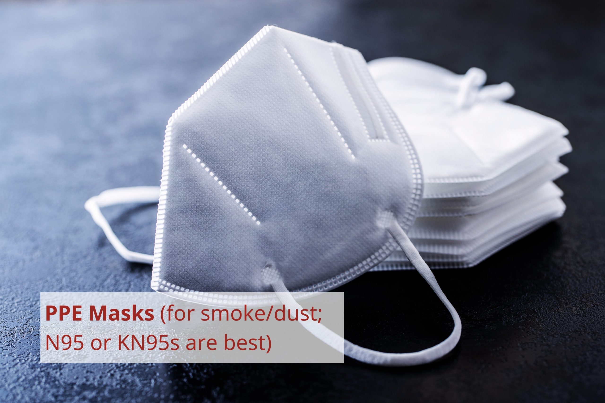
- Wear properly fitted N95 or KN95 masks.
- If possible, avoid heavy exertion outdoors in smoky conditions.
Other Wildfire Smoke & Air Quality Resources
The following resources are not produced or maintained by the project.
A public health companion for ASHRAE Guideline 44: Protecting building occupants from smoke during wildfire and prescribed burn events
National Collaborating Centre for Environmental Health (2025)
This guide is a companion to a technical document for engineers and facility managers trying to keep indoor air clean during wildfire smoke events. It provides a guide for developing smoke-readiness plans for buildings. The checklists and one-page summary in the appendices may be particularly useful as a reference.
SFU BREATHE DIY Air Cleaners
SFU BREATHE Project (2024)
The BREATHE project helps communities prepare for wildfire smoke exposure and has published resources to help folks build their own air cleaners using a box fan, filter, duct tape, and scissors.
Housing, Building Materials, and Landscapes
Innovations in building materials and best practices can aid in designing more fire-resilient housing. This section covers information on those materials and best practices. Recognising that homes often extend beyond a human-constructed structure, it also includes resources with information about fire-resilient landscaping.
More information about climate-resilient building materials can be found on the project’s Building Materials page.
Fire-Resilient Building Materials

Rammed Earth
4-hour fire rating
Rammed earth is made from compacted layers of earth.
It can be used for infill walls with steel or timber framing and for load-bearing walls. Estimated cost of $250-$350/square foot, with some materials available locally in BC.
Straw Bale
1-2-hour fire rating with plaster, 30 minutes without.
Straw bale can be used for infill with timber or steel-frame walls. Estimated cost of $180-$208/square foot, with local materials largely available in BC.
Cob
2-4-hour fire rating.
Cob is made from clay, straw, sand, water, and lime, all of which are widely available within BC. Cob is often used for infill post and beam/timber framing walls. Cob can be used for load-bearing walls depending on the climate.

Hempcrete
1-hour (or more) fire rating.
Hempcrete blocks are made from hemp, lime, and water. Their low compressive strength means they are typically used as infill in walls within a timber or steel frame. Materials widely available locally.

Autoclaved Aerated Concrete (AAC)
2-4-hour fire rating
Mineral-based building material made from sand, water, limestone, cement, and aluminum powder cured under high heat/pressure in an autoclave. AAC blocks can be used for load-bearing walls or cladding. Limited availability within Canada.
Mass Timber
3+ hour fire rating
Mass timber construction uses engineered wood products, such as cross-laminated timber (CLT), glulam, and nail-laminated timber (NLT), which are formed by bonding layers of wood with adhesives or fasteners. Surface char creates a protective layer. In BC, relatively high costs of $400–$450 per square foot.
Retrofits
Not building a new structure? Simple, relatively affordable retrofits like a fire-rated door, gutter guards, or an upgraded chimney can make a big difference.
External Resources
Other organisations and groups have produced resources about fire-resilient housing, building materials, and landscaping. The resources below are not produced or maintained by the project.
FireSmart Residential Development Guide
Best Practices for Planning, Design, and Construction
FireSmart Canada™ (2025)
This document is based on the FireSmart Development Planning and Design Best Practices and the NRC-National Guide for Wildland-Urban
Interface Fires. It shares principles and best practices for planning, design, and construction of homes to make them more resilient to wildland fires. Example diagrams are provided in the Appendix (page 21 onwards).
Village of Lytton – Fire Resilient Community Fact Sheet
Village of Lytton (2024)
This is a one-page list of recommendations related to landscaping and building to reduce the risk of fire spread and damage, building from the Village’s experience with a destructive wildfire in 2021.
The right column is focused on building recommendations, while the left is about landscaping.
West Coast Building Standard: Residential Construction Specifications
Richard Hall, Nuxalk Nation Housing Specialist and Advisor (2023)
This guide shares solutions for affordable, energy-efficient homes for coastal areas. The guidelines lead to units that are 20% more efficient compared to the baseline requirements of the BC Building Code (Energy Code Step 3). The standard also includes culturally appropriate features, such as a shared cultural kitchen for canning, skinning, and weaving.
Six short videos – Richard & Friends – complement this publication and are available on the BCIT website.
FireSmart Fact Sheet: Siding
FireSmart Canada (2022)
Exterior walls – siding – are a fire safety risk because damage to siding can allow fires to reach underlying walls and penetrate a building’s interior. This one-page document provides guidelines for those who are considering renovating siding to promote fire resilience.
FireSmart has also produced a more comprehensive home development guide that recommends designs, materials, and practices to reduce a building’s vulnerability to wildfire.
Cool Roofs and Walls to Reduce Heat Gain
Building America Solution Centre, Office of Energy Efficiency & Renewable Energy (2023)
‘Cool’ roofs or walls use materials or coatings that stay relatively cool when the sun shines directly on them, which reduces heat conducted into the building. Cool roofs and walls improve comfort and energy efficiency, especially during periods of extreme heat.
Climate zones are only mapped for the United States on the website. BC’s climate zones can be found on Better Homes BC.
Three Steps to a Cost-Effective FireSmart™ Home
Intact Centre on Climate Adaptation at the University of Waterloo (2023)
This document provides guidance on landscaping and home upgrades that improve a home’s fire resilience, including options that do not require working with a contractor and can be done by a resident and/or their community.
The low-cost options in step 1 are related to landscaping and home maintenance.
Capacity Building & Funding Resources
Getting started with fire-resilient practices can be challenging, especially without dedicated funding or support. This section offers some curated funding and capacity building resources for rural and remote communities in BC.
Click on a card for more details about the funding program.
Contact Us
This handbook is a ‘living site’! We welcome your feedback and ideas. The handbook will be continually updated and improved based on community contributions and feedback.
FireSmart, Intelli-feu and other associated Marks are trademarks of the Canadian Interagency Forest Fire Centre Inc.